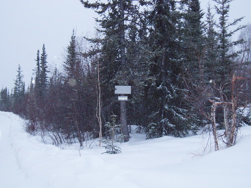
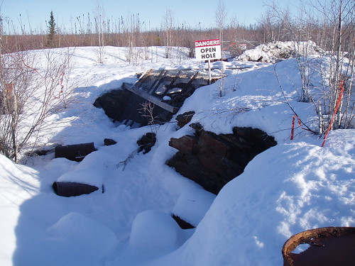
Out on the Canol Trail
Saturday, August 14, 2010, 11:17:33 PM | donkeycat
I’m sorry that it has taken so long to update the blog, but out on the Canol Trail we had very limited access to the internet. There was only a very small bandwidth (what ever that is) and with the team leaders having to post there daily reports and responding to e-mail, and us working from 07:00hrs to 00:00hrs every day there was not enough time to sit and write.
(I’m now at Sawmill Bay another abandoned military site in the NWT to oversee a clean up and I will have the time write)
Anyhow here is where I was…
History:
One of the most remote trails in the world, the Canol Heritage Trail sits on the remains of the Canol Road, built during World War II by the United States Army to support an oil pipeline. The trail runs over 200 miles from Macmillan Pass at the eastern edge of the Yukon Territory to Norman Wells, Northwest Territories.
The CANOL (Canadian Oil) project was one of the most expensive of World War II. Undertaken at the same time as the Alaska Highway project, the CANOL project was designed to provide oil for vehicles used in construction of the Alaska Highway and to ensure an oil supply for US and Canadian troops in the far north.
With the Japanese occupation of the Aleutian Islands, the US Army was very concerned about the security of Alaska, then a US territory. The US Army decided that it needed to have land-based access to Alaska, and set about to build the Alaska Highway, connecting Dawson Creek, BC to Fairbanks, AK. At the same time, the US Army decided to run a pipeline from Norman Wells on the Mackenzie River to Whitehorse, YT, to provide oil for the machinery working on the Alaska Highway. At the time, the oil in Norman Wells was more easily accessible than that in Alaska's North Slope.
Although more easily accessible than Alaskan oil, the oilfields in Norman Wells were not easily reached. Construction of the pipeline and a road to support the pipeline took up most of the war. Construction began in 1942 (slightly prior to notification of Canadian authorities) and lasted until February 1944. Horrible conditions meant for slow going in the construction process, and, even after the pipeline opened, it operated for a very short time- until March 1945. Problems in welds meant for large amounts of oil being lost from the pipeline. The effects of these oil spills can still be seen on the land around the Canol Heritage Trail today.
After the pipeline was closed, the road fell into disuse except for the section in the Yukon Territory. The CANOL project remained largely forgotten until the 1960s, when an increase of interest into wilderness hiking led to the establishment of the Canol Heritage Trail. While basically unmaintained, the Canol Heritage Trail provides an opportunity to see this unique part of the Northwest Territories and see the remains of one of the most colossal wartime projects in Canadian history.
Our mission:
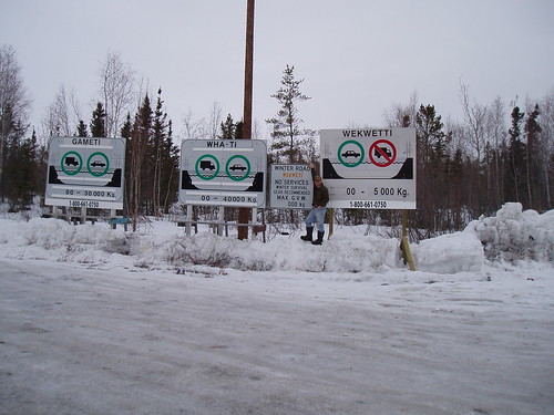
The SENES/Franz teams were charged with conducting an environmental assessment of several locations along the trail. The Team 1 (Franz) was stationed in Norman Wells the
Teams 2 (Franz) and Team 3 (SENES) were stationed at Ram Head Outfitters (http://www.ramheadoutfitters.com/) at the ~180 mile mark on trail at Godlin Lake. Team 1 worked west from Norman Wells with Team 2 working east from Ram Head toward Norman Wells. The Team 3 worked west from Ran Head into the Mackenzie Mountains and the Yukon border.
Our Team

Front right – Charles Gravelle - Team leader, report writer and solver of problems.
Front left – Jamie Ricci - DGPS expert, wildlife monitor and sorter of coolers.
Back right – Collin Sam – Designated substance specialist and excavator of shallow test pits.
Back left – Patrick Harrison –EM surveyor, maker of tea and carrier of heavy things.
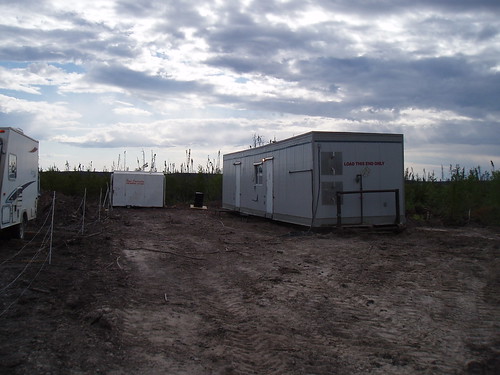
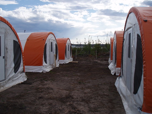
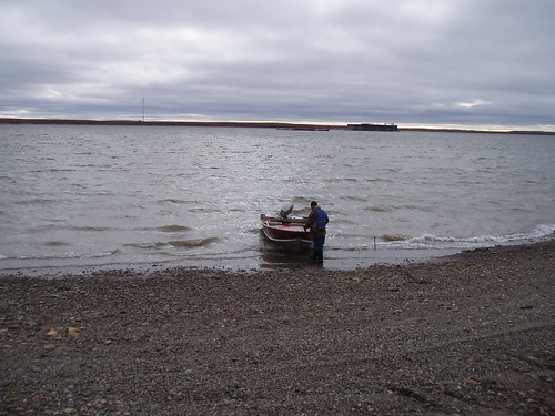
Ram Head Outfitting


Dining tent/office

Our cabin
The laundry machine
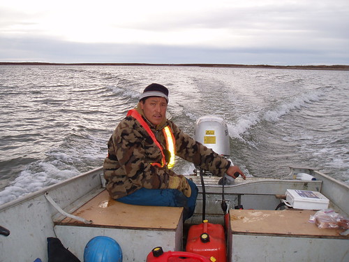
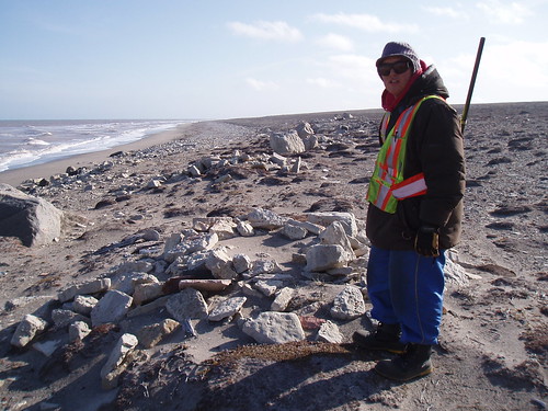
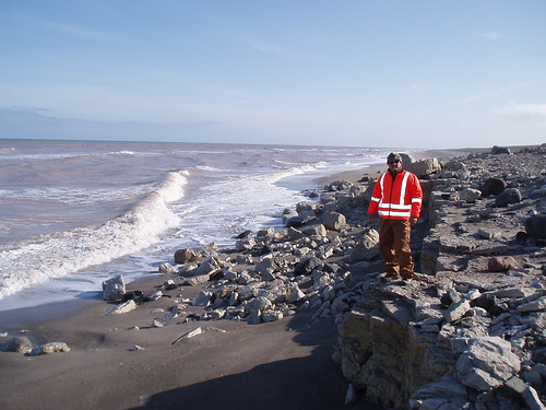
On the job site

that's me conducting an EM survey.

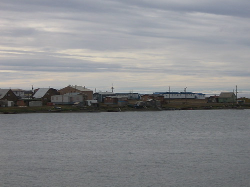
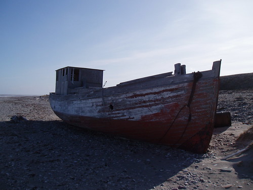
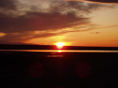
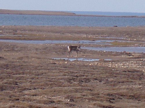
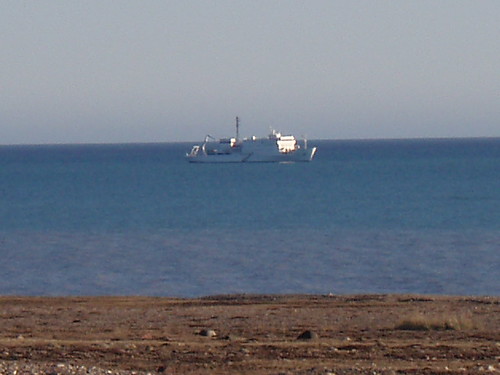
Some general photos of the areas we were working in.
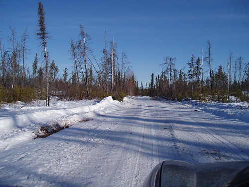
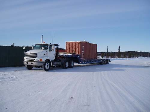
The trip from Normal Wells to Ram Head
Our side trip - We went to the glacier at Mt. Keele in the Yukon to get ice to keep our samples cool.


And some fun photos to end on.
Collin hard at work.

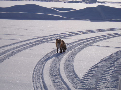
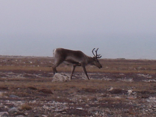
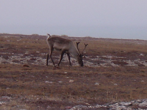
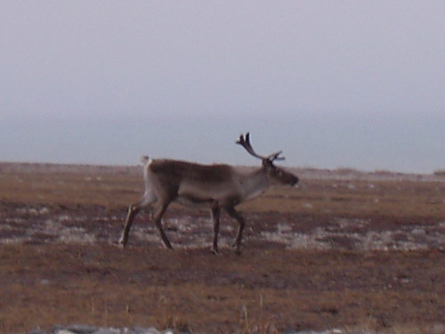
Caribou Jamie

Wolf tracks
Cheers
Pat
photos to come..again with the band width......
June 24 2010
Friday, June 25, 2010, 11:29:21 AM | donkeycat
Well things are wrapping up at site. The bulk of the work has been done the only thing left to do is the concrete cap on the mine shaft, this will be done at a later date….not sure when or who will be on site for that, likely not me.
Well there you have it not a very exciting 2 weeks on the land it was good to be here but now that we are in wind up mode I’m getting excited about going home on saturday.
Well it looks like I spoke to soon…..the concrete cap work will take place on Saturday, so there you have it I will now be leaving on Sunday, I hope.
Cheers
Pat
A sad day on site today.
Wednesday, June 23, 2010, 9:36:12 AM | donkeycat
June 21, 2010
Pete D’Andiea our camp manager (he served in Rwanda with General Dallaire) received word from home that his cousin Sgt. James Macneil of Glace Bay, N.S was killed in action by an IED.
His son is in hospital in Ottawa after being wounded in action, he has another son still in Afghanistan and a daughter in the military in Edmonton.
This is a family devoted to protecting the Canadian way of life.
Safe Home Pete.
Last three days
Wednesday, June 23, 2010, 9:33:29 AM | donkeycat
June 18 2010
The other day we saw this on the news and the entire crew just broke out in laughter.
The mosquito population in Estonia is down by at least 400 after the Baltic state hosted its first-ever mosquito-catching championship. Skip related content
Related photos / videos
Thirty-seven participants gathered in a field in the city of Tartu to take part in the unusual competition. The field was divided into three-square-metre segments where participants, either individuals or in teams of up to three, collected as many mosquitoes as possible in ten minutes.
The competition rules did not state whether the collected mosquitoes had to be dead or alive.
The winner in the individual participant category was Rauno Luksepp who caught 38 mosquitoes but accumulated about as many bites in the process.
"My legs and arms hurt and itch since the championship. But I feel good now," Luksepp said.
The idea of the championship came from Finland, where there have been mosquito-catching championships in the past.
We were thinking of inviting them to camp to see how they would hold up against our files. 30 mosquitoes in 10 minutes would be like being in heaven.
Here is a web site for some information on the NWT. http://www.spectacularnwt.com/
As you can see I’m starting to get a little board, the work is going well, the camp is sufficient (although my trailer is located between two sewage pits – the one for the main camp and the one for my trailer, I don’t know if the contractor planned it this way) the food is…well…not to bad. This is only the 4th or 5th time the cook has been in a camp like this and she is having to deal with an oven that has no thermostat, (most dinners are slightly overcooked or undercooked) supplies and ingredients that are nonexistent (we are eating a lot of pancakes and bacon and canned vegetables) but everything she cooks gets eaten. The location is awful, rock outcropping surrounded by thick willows and swamp. The typical weather up here has been; temperatures between 8 and 13 degrees, overcast and windy. We have had a little rain but barely enough to wet the ground. Sun rise is at 0340hrs and sunset comes at 2338hrs.
Our scheduled flight came in today, bringing with it a surveyor (to do a topographical map of the site before the remediation work is started and again after the work has been completed) and our food supplies.
So for the 7 hours that the surveyor was on site I got to play wildlife monitor and stand at the mine site and watch her walk back and forth doing her GPS survey. Not very exciting for her and even less so for me. Anyhow she finished her work and was on a plane that evening.
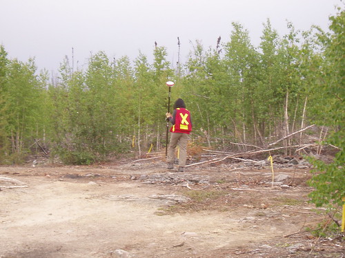
Our surveyor making a topographical map of the site.
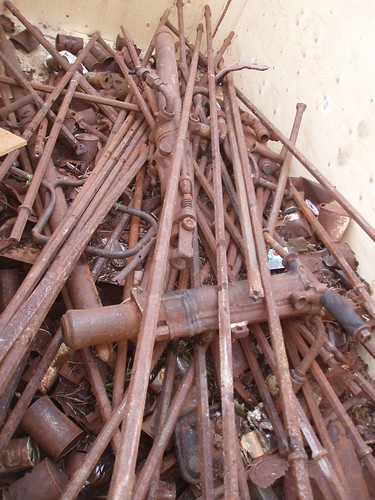
Drillsteel, jacklegs and drill, all found in the bush to the north is the site.
Saturday June 19, 2010
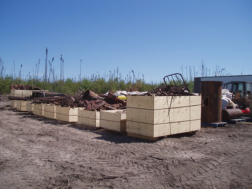
Today we started removing the tailings from the mine site. They are collected up and placed in mega bags and then loaded into the trailer. Another day standing, watching and taking photos.
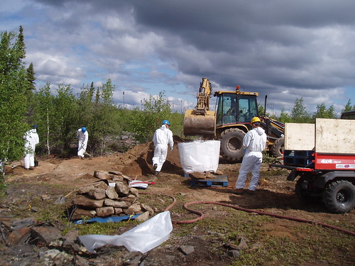
Collection of the tailings at the mine site.
My little son Thomas caught his first fish today. CONGRADULATIONS!
Sunday June 20 2010
HAPPY FATHER’S DAY
It is not flesh and blood but the heart which makes us fathers and sons. ~Johann Schiller (don’t know who he is, but I likes the thought)
My dad didn't tell me how to live; he lived, and let me watch him do it.
It is only after becoming a father that I realized what a difficult and demanding job it really is. One full of sleepless nights, lots of driving around, missing sweaters, ties, ashtrays in the shape of hands, and an absence of pocket change. The giving and receiving of advice on how to do things, the teaching of the things that you like and the learning of the things that interest them. The fear of what will happen to them and wonder of what will they become when they go out on there own.
I have had a wonderful roll model, thanks DAD and Happy Father’s Day.
Today we continued with the tailings removal until 0900hrs when it started to rain. The rain fell until around 1500hrs allowing everybody to get some much needed sleep (it appears that I was not the only on in the camp that was having trouble sleeping, the flies and the generator have been keeping everyone awake).
As soon as the rain stopped we were back at it, collection and bagging the tailings, however now the humidity is way up and so are the flies. We shall see what tomorrow has in store for us.
Time to take a much needed shower (no not the first since I’ve in camp)
Cheers
Pat
The other day we saw this on the news and the entire crew just broke out in laughter.
The mosquito population in Estonia is down by at least 400 after the Baltic state hosted its first-ever mosquito-catching championship. Skip related content
Related photos / videos
Thirty-seven participants gathered in a field in the city of Tartu to take part in the unusual competition. The field was divided into three-square-metre segments where participants, either individuals or in teams of up to three, collected as many mosquitoes as possible in ten minutes.
The competition rules did not state whether the collected mosquitoes had to be dead or alive.
The winner in the individual participant category was Rauno Luksepp who caught 38 mosquitoes but accumulated about as many bites in the process.
"My legs and arms hurt and itch since the championship. But I feel good now," Luksepp said.
The idea of the championship came from Finland, where there have been mosquito-catching championships in the past.
We were thinking of inviting them to camp to see how they would hold up against our files. 30 mosquitoes in 10 minutes would be like being in heaven.
Here is a web site for some information on the NWT. http://www.spectacularnwt.com/
As you can see I’m starting to get a little board, the work is going well, the camp is sufficient (although my trailer is located between two sewage pits – the one for the main camp and the one for my trailer, I don’t know if the contractor planned it this way) the food is…well…not to bad. This is only the 4th or 5th time the cook has been in a camp like this and she is having to deal with an oven that has no thermostat, (most dinners are slightly overcooked or undercooked) supplies and ingredients that are nonexistent (we are eating a lot of pancakes and bacon and canned vegetables) but everything she cooks gets eaten. The location is awful, rock outcropping surrounded by thick willows and swamp. The typical weather up here has been; temperatures between 8 and 13 degrees, overcast and windy. We have had a little rain but barely enough to wet the ground. Sun rise is at 0340hrs and sunset comes at 2338hrs.
Our scheduled flight came in today, bringing with it a surveyor (to do a topographical map of the site before the remediation work is started and again after the work has been completed) and our food supplies.
So for the 7 hours that the surveyor was on site I got to play wildlife monitor and stand at the mine site and watch her walk back and forth doing her GPS survey. Not very exciting for her and even less so for me. Anyhow she finished her work and was on a plane that evening.
Our surveyor making a topographical map of the site.
Drillsteel, jacklegs and drill, all found in the bush to the north is the site.
Saturday June 19, 2010
Today we started removing the tailings from the mine site. They are collected up and placed in mega bags and then loaded into the trailer. Another day standing, watching and taking photos.
Collection of the tailings at the mine site.
Sunday June 20 2010
HAPPY FATHER’S DAY
It is not flesh and blood but the heart which makes us fathers and sons. ~Johann Schiller (don’t know who he is, but I likes the thought)
My dad didn't tell me how to live; he lived, and let me watch him do it.
It is only after becoming a father that I realized what a difficult and demanding job it really is. One full of sleepless nights, lots of driving around, missing sweaters, ties, ashtrays in the shape of hands, and an absence of pocket change. The giving and receiving of advice on how to do things, the teaching of the things that you like and the learning of the things that interest them. The fear of what will happen to them and wonder of what will they become when they go out on there own.
I have had a wonderful roll model, thanks DAD and Happy Father’s Day.
Today we continued with the tailings removal until 0900hrs when it started to rain. The rain fell until around 1500hrs allowing everybody to get some much needed sleep (it appears that I was not the only on in the camp that was having trouble sleeping, the flies and the generator have been keeping everyone awake).
As soon as the rain stopped we were back at it, collection and bagging the tailings, however now the humidity is way up and so are the flies. We shall see what tomorrow has in store for us.
Time to take a much needed shower (no not the first since I’ve in camp)
Cheers
Pat
The days keep on rolling bye...
Friday, June 18, 2010, 10:55:15 AM | donkeycat
June 16 2010
Nothing to out of the ordinary to report. The work is going very fast, with any luck my replacement will have very little to do.
Looks like I wrote this a little to early, just as I was getting use to the generator hum, I was almost asleep last night when the generator quit, all was quiet, leaving me to listen to the whine of the mosquitoes. Another sleepless night. I did manage to grab some z’s after lunch.
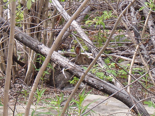
one of our site visiters, a snowshoe hare, I'll try to get a photo of the moose if I see him.
Bear fence around my trailer.
Some of the scrap metal we have cleaned up todate.
Placement of the silt fence before removal of any debris from in the water can begin.
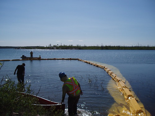
Placement of the silt fence.
June 17 2010
Today was sampling day!! All that meant was I got to something other than walk around taking photos and making notes. In the afternoon the contractor installed the silt fence and removed the debris from the lake. He made his crew (which I think are mostly his kids and nephews) work in the water wearing there leather work boots and jeans. They were in the water for up to an hour. That water is cold. But as he told me “these kids grew up in this water” after the work was completed they changed into dry clothing and continued with other work around the site.
We finally got a mosquitoe pick for our trailer, the generator is running so I may get a good sleep tonight.
I found some photos of the snowking winter festival in Yellowknife from when I was there in April.
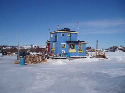
House boat on Great Slave Lake.
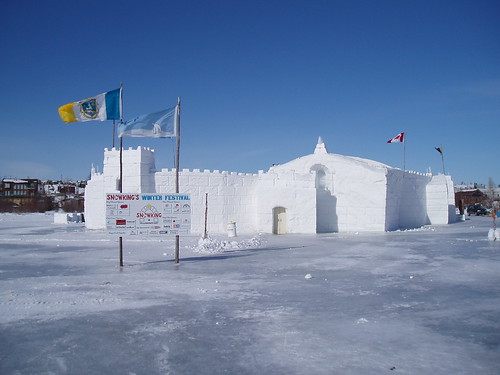
Ice Castle on Great Slave Lake.
Cheers
Pat
Nothing to out of the ordinary to report. The work is going very fast, with any luck my replacement will have very little to do.
Looks like I wrote this a little to early, just as I was getting use to the generator hum, I was almost asleep last night when the generator quit, all was quiet, leaving me to listen to the whine of the mosquitoes. Another sleepless night. I did manage to grab some z’s after lunch.
one of our site visiters, a snowshoe hare, I'll try to get a photo of the moose if I see him.
Bear fence around my trailer.
Some of the scrap metal we have cleaned up todate.
Placement of the silt fence before removal of any debris from in the water can begin.
Placement of the silt fence.
June 17 2010
Today was sampling day!! All that meant was I got to something other than walk around taking photos and making notes. In the afternoon the contractor installed the silt fence and removed the debris from the lake. He made his crew (which I think are mostly his kids and nephews) work in the water wearing there leather work boots and jeans. They were in the water for up to an hour. That water is cold. But as he told me “these kids grew up in this water” after the work was completed they changed into dry clothing and continued with other work around the site.
We finally got a mosquitoe pick for our trailer, the generator is running so I may get a good sleep tonight.
I found some photos of the snowking winter festival in Yellowknife from when I was there in April.
House boat on Great Slave Lake.
Ice Castle on Great Slave Lake.
Cheers
Pat
Good morning or I should just say morning, very early morning…..
Thursday, June 17, 2010, 11:03:30 PM | donkeycat
Well here it is 0430hrs on Tuesday June 15 and I’m looking out my mosquito covered window at a overcast sky.
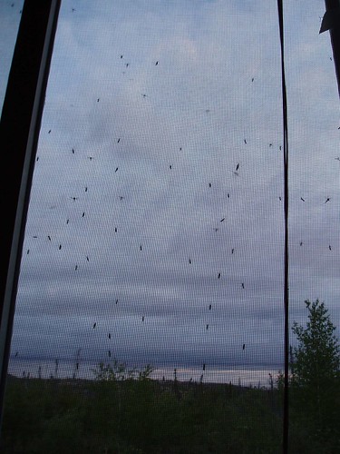
The reason that I’m up so very early today is that I slept very little last night due the hum of the generator and the whine of the mosquitoes. Its like trying to sleep in a small shed with the lawn mower running (no exhaust), I used ear plugs (had some old ones in my work vest) but still only managed to get about 50 minutes and hour of sleep. The mosquitoes in the room were not to bad, only one or two bites that I felt, but with the ear plugs in and the genset running I would not have hear them buzzing around even if they were in here. Well I have to go and find a toilet tree and dodge the little blood suckers.
Well I have indoor plumbing in my trailer now and we are getting closer to the bear fence. Within the next couple of days we should be inside. They have dragged my trailer closer to the camp and are planning to extend the fence that is if they have enough wire.
The weather up here is cool to cold at night (heaters are on in the trailers and tents) it’s been overcast with light showers and mostly windy (thank God, it keeps the flies down).
The work on site is going very fast and it is possible that the cleanup will be done before the scheduled completion date.
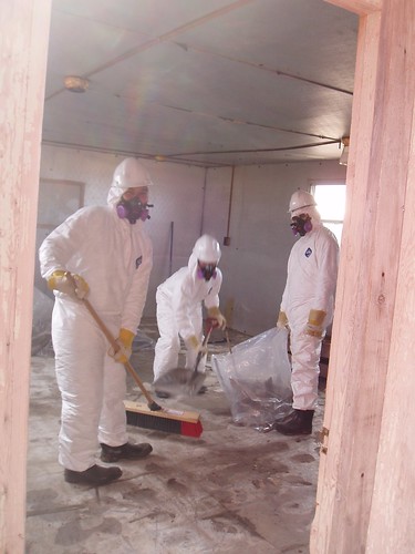
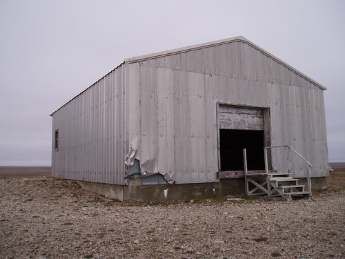
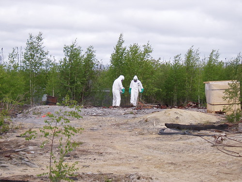 Clean up of asbestos containing material.
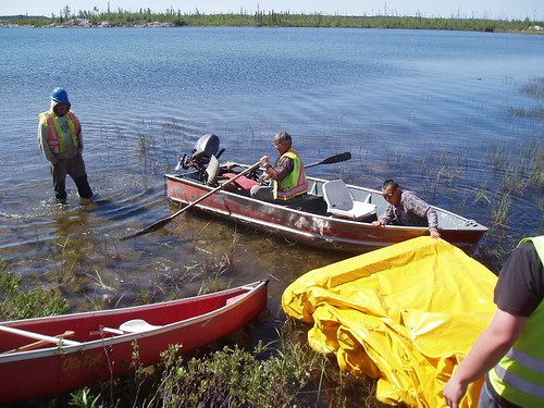
I managed to get out on the lake last night and do some lake sounding and benthic work (that’s what we have to call it as we are not allowed to go fishing) with the contractor and his consultant. We did get some beautiful samples.
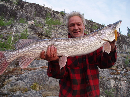 Gus our mechanic with a Pike (jackfish as they are locally known) it was live released.
Background Information on Hidden Lake
The Hidden Lake Mine, sometimes called the Ragged Ass Mine, was a small high-grade gold mining operation that was most active in the late 1960s. The first claims were staked in the mid 1930s and, starting in 1940, development consisted of a shaft, limited underground workings and two small surface pits. Although some high-grade ore was recovered, water problems resulted in the abandonment of the mine. The Hidden Lake Mine presently exists as an abandoned site and is under management of Indian and Northern Affairs Canada (INAC), Contaminants and Remediation Directorate (CARD).
The Hidden Lake Mine is located approximately 45 km northeast of Yellowknife, in the Northwest Territories, Canada. The site is situated on the eastern shore of Hidden Lake approximately 8 km north of Ingraham Trail (13 km by the former winter road route that starts at the Ingraham Trail. Summer access to the site is currently by fixed-wing aircraft on floats, helicopter, canoe (with portages) or a marshy, water logged overland trail. The overland trail is synonymous to the former winter road route which was used to service the mine. The route runs through mostly swamp and bog terrain and therefore summer vehicular access is significantly limited. In addition, shallow depths of water on Hidden Lake may cause some concerns for fix-wing aircrafts landing on the water. Winter land access could be achieved via the route of former winter road.
The site lies within the asserted Akaitcho Dene territory, inside the Môwhì Gogha De Nîîtåèè boundary within the Wek’èezhìi management area of the Tåîchô settlement area, and the traditional lands identified by the North Slave Métis Alliance.
Sites with information on Hidden Lake Mine Site:
http://www.ainc-inac.gc.ca/ai/scr/nt/cnt/cln/csr/aka/hdl/index-eng.asp
http://dsp-psd.pwgsc.gc.ca/collections/collection_2010/ainc-inac/R12-28-2009-1-eng.pdf
Site with information on the Hidden Lake Park, on Hidden Lake, which is located at the opposite side from the mine.
http://www.iti.gov.nt.ca/tourismparks/parks/parks/hidden_lake_territorial_park.shtml
Well its almost 2330hrs and time to try to get some sleep. Sunrise up here is at 0340hrs and sunset is at 2336hrs so I have to take advantage of all the darkness I can get.
Cheers for now
Pat
The reason that I’m up so very early today is that I slept very little last night due the hum of the generator and the whine of the mosquitoes. Its like trying to sleep in a small shed with the lawn mower running (no exhaust), I used ear plugs (had some old ones in my work vest) but still only managed to get about 50 minutes and hour of sleep. The mosquitoes in the room were not to bad, only one or two bites that I felt, but with the ear plugs in and the genset running I would not have hear them buzzing around even if they were in here. Well I have to go and find a toilet tree and dodge the little blood suckers.
Well I have indoor plumbing in my trailer now and we are getting closer to the bear fence. Within the next couple of days we should be inside. They have dragged my trailer closer to the camp and are planning to extend the fence that is if they have enough wire.
The weather up here is cool to cold at night (heaters are on in the trailers and tents) it’s been overcast with light showers and mostly windy (thank God, it keeps the flies down).
The work on site is going very fast and it is possible that the cleanup will be done before the scheduled completion date.
I managed to get out on the lake last night and do some lake sounding and benthic work (that’s what we have to call it as we are not allowed to go fishing) with the contractor and his consultant. We did get some beautiful samples.
Background Information on Hidden Lake
The Hidden Lake Mine, sometimes called the Ragged Ass Mine, was a small high-grade gold mining operation that was most active in the late 1960s. The first claims were staked in the mid 1930s and, starting in 1940, development consisted of a shaft, limited underground workings and two small surface pits. Although some high-grade ore was recovered, water problems resulted in the abandonment of the mine. The Hidden Lake Mine presently exists as an abandoned site and is under management of Indian and Northern Affairs Canada (INAC), Contaminants and Remediation Directorate (CARD).
The Hidden Lake Mine is located approximately 45 km northeast of Yellowknife, in the Northwest Territories, Canada. The site is situated on the eastern shore of Hidden Lake approximately 8 km north of Ingraham Trail (13 km by the former winter road route that starts at the Ingraham Trail. Summer access to the site is currently by fixed-wing aircraft on floats, helicopter, canoe (with portages) or a marshy, water logged overland trail. The overland trail is synonymous to the former winter road route which was used to service the mine. The route runs through mostly swamp and bog terrain and therefore summer vehicular access is significantly limited. In addition, shallow depths of water on Hidden Lake may cause some concerns for fix-wing aircrafts landing on the water. Winter land access could be achieved via the route of former winter road.
The site lies within the asserted Akaitcho Dene territory, inside the Môwhì Gogha De Nîîtåèè boundary within the Wek’èezhìi management area of the Tåîchô settlement area, and the traditional lands identified by the North Slave Métis Alliance.
Sites with information on Hidden Lake Mine Site:
http://www.ainc-inac.gc.ca/ai/scr/nt/cnt/cln/csr/aka/hdl/index-eng.asp
http://dsp-psd.pwgsc.gc.ca/collections/collection_2010/ainc-inac/R12-28-2009-1-eng.pdf
Site with information on the Hidden Lake Park, on Hidden Lake, which is located at the opposite side from the mine.
http://www.iti.gov.nt.ca/tourismparks/parks/parks/hidden_lake_territorial_park.shtml
Well its almost 2330hrs and time to try to get some sleep. Sunrise up here is at 0340hrs and sunset is at 2336hrs so I have to take advantage of all the darkness I can get.
Cheers for now
Pat
Return to the North…..
Monday, June 14, 2010, 10:29:27 PM | donkeycat
Sunday June 13, 2010
I arrived in Yellowknife to a beautiful summer day, from there on it was down hill….
Monday June 14, 2010
I was awaken at 0600hrs by a phone call from a friend, who was staying at the same hotel, asking to borrow $20 so he could get a bottle to nurse a hangover.
At 1500hrs we, my job shadow and I, arrived at the float plane base for our flight into Hidden Lake. After some adjusting of baggage and food supplies (half of which was left behind to take a later flight) we were finally in the air for our 12 minute flight to the site.
Our flight was uneventful and we were greeted by the site superintendant and a swarm of mosquitoes, the site is almost in a swamp and since being here I have lost a quart of blood. LOL
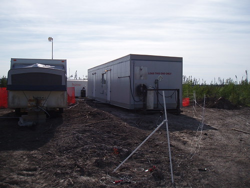
The camp is a nice setup with winter haven tents complete with electricity computer internet, oil stoves, ect. All contained within the bear fence. However the consultant’s trailer is outside the fence beside the generator and down wind of the septic pond. It’s not quite hell but its close. We have no phone setup yet, however the ‘I’ phones work on site but I do not have one of those. There is a slight problem with the water, well not the water itself, but the getting of it from the source to where we need it, namely the kitchen so dinner will be late tonight.
Well here it is….dinner was served at 2000hrs, a combination of spaghetti with some kind of watered down meat sauce and chicken breasts with come kind of mushroom sauce. The bread is all frozen, there are no eggs for breakfast. This is going to be one very interesting tour.
About the bugs, there are millions and millions of misquotes, black flies and deer flies (these are all over an inch in size) just waiting to bite. Any and all exposed skin is a target, even taking a pee in the bush is a challenge.
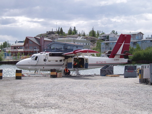
Loading the Twin Otter.
Loaded to go.
My new home...note the bear fence on the left.
The real camp.....
Cheers
Pat
Sorry it took so long to post this, but I did not have access to the internet until today.
Tuesday, April 27, 2010, 12:50:01 PM | donkeycat
On the ice road….
Monday morning to 0530hrs we finished loading our personal gear into the Ford F250 for the 3 to 4 hour (depending on how fast you drive) drive back to Yellowknife. The first couple of hours passed rather quickly and uneventfully, across a lake through a portage, back on a lake, over another portage and back on a lake, etc…. even though it was dark the moon was bright and the drive was fun. At sun rise things changes drastically, the sun shown for only a few minutes before the ice fog rolled in, this coupled with the flat light gave a very eerie feeling to trip.
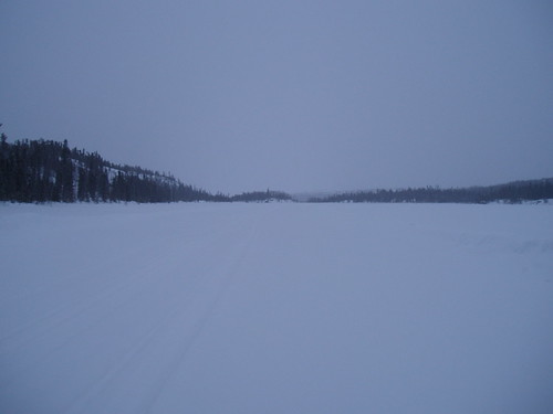
Ice road going across a lake.
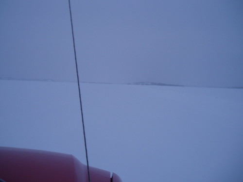
Going across another lake, Can you spot the road?

One of the portages, a fire had gone through a few years back and this is what was left.
It was very hard to tell where the snow banks, push ups (this is where a chunk of ice is pushed up
through the road, these can range in size from that of a soccer ball to a coffee table) and turns were. We had a couple of close calls with the push ups (although the ice road cops try to mark them with orange paint) and a few slides around the corners in the approach to the portages and several bottoming outs on the humps and bumps of the portages. Up until we reached the entrance of portage #16 things were going OK and we were making good time.
Entrance to Portage #16.

Our truck in the snow bank.
As we reached the approach for the portage we noticed the very sharp turn to late, and the truck slid off the road and into the snow bank. After a quick assessment of the situation and a brief discussion on possible extraction methods, I wanted to try the flip-flop winch however Josh chose the D1 method. He made the right choice as a 21 year old using a shovel had the truck dug out before the 46 year old could have had the flip-flop in place. Anyhow 20 minutes later we were back on the road. By 1000hrs we had reached the main highway and were on the last stretch to Yellowknife and at 1045hrs Josh dropped me off at the hotel, we had arrived approximately 25 minutes before the plane would land in town if it had flown at all due to the fog.
End of the ice road.
As I was checking into the Yellowknife Inn, I was informed that there was no room in my name and that they were booked solid, I made a quick call to the office to find out what was going on and was told that I was at the wrong place but that Henry (our man in Yellowknife) would be along shortly to collect me and get me to the right place. As Yellowknife is very small and our office is just across the intersection, Henry, dropped off his car and asked me to check on another project called Hidden Lake, which is about an hour from town. The contractor was working on site and a site inspection needed to be done. As I did have the time, I checked into the right hotel and hit the road again. First asphalt, then gravel and finally ice road again. I don’t know much about Hidden lake (or as it was otherwise known Ragged Ass) Mine except that its about an hour and a bit drive from Yellowknife (75km) down the beautiful Ingram Trail and 20-30 minutes on the ice road. Hidden lake is a very small mine site on a rather large lake with excellent fishing, if I end up going north this summer I wouldn’t mind being here. I post more about the site when I get time and find the information.
Ice road into Hidden Lake Mine.
The shaft at Hidden Lake Mine.

Loading up the truck with the compressor and diesel motor to be removed from site.
That’s all for now
Cheers
Pat
Monday morning to 0530hrs we finished loading our personal gear into the Ford F250 for the 3 to 4 hour (depending on how fast you drive) drive back to Yellowknife. The first couple of hours passed rather quickly and uneventfully, across a lake through a portage, back on a lake, over another portage and back on a lake, etc…. even though it was dark the moon was bright and the drive was fun. At sun rise things changes drastically, the sun shown for only a few minutes before the ice fog rolled in, this coupled with the flat light gave a very eerie feeling to trip.
Ice road going across a lake.
Going across another lake, Can you spot the road?
One of the portages, a fire had gone through a few years back and this is what was left.
It was very hard to tell where the snow banks, push ups (this is where a chunk of ice is pushed up
through the road, these can range in size from that of a soccer ball to a coffee table) and turns were. We had a couple of close calls with the push ups (although the ice road cops try to mark them with orange paint) and a few slides around the corners in the approach to the portages and several bottoming outs on the humps and bumps of the portages. Up until we reached the entrance of portage #16 things were going OK and we were making good time.
Entrance to Portage #16.
Our truck in the snow bank.
End of the ice road.
As I was checking into the Yellowknife Inn, I was informed that there was no room in my name and that they were booked solid, I made a quick call to the office to find out what was going on and was told that I was at the wrong place but that Henry (our man in Yellowknife) would be along shortly to collect me and get me to the right place. As Yellowknife is very small and our office is just across the intersection, Henry, dropped off his car and asked me to check on another project called Hidden Lake, which is about an hour from town. The contractor was working on site and a site inspection needed to be done. As I did have the time, I checked into the right hotel and hit the road again. First asphalt, then gravel and finally ice road again. I don’t know much about Hidden lake (or as it was otherwise known Ragged Ass) Mine except that its about an hour and a bit drive from Yellowknife (75km) down the beautiful Ingram Trail and 20-30 minutes on the ice road. Hidden lake is a very small mine site on a rather large lake with excellent fishing, if I end up going north this summer I wouldn’t mind being here. I post more about the site when I get time and find the information.
Ice road into Hidden Lake Mine.
The shaft at Hidden Lake Mine.
Loading up the truck with the compressor and diesel motor to be removed from site.
That’s all for now
Cheers
Pat
Sunday, March 28, 2010, 9:03:22 PM | donkeycat
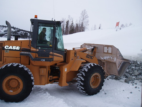
Operator for a day………
Saturday was my first full day as a loader operator at the North Inca site. For 12 hours I ran a Case 821C articulated loader moving snow, moving and placing rip-rap and with the forklift attachment I loaded scrap into the rock trucks for their back haul to Colomac. By days end I was tired, fulfilled and I had a lot of fun.
 Sunday our day of rest (if you can call 12 hours of moderate to light duty rest) at 0630hrs we left the camp for the site. What a beautiful morning and only -19C. we arrived on site and at 0700hrs with the Sterling truck and flatbed, to finish the rip-rap work (Josh Osmand, a Newfoundlander, and the operator of the excavator and myself on the Case), do some touchup work on site, have a training session (what a blast, I’m thinking of taking a heavy equipment operators course) on the excavator and bring the equipment back to Colomac all before dinner, the reason that we moved so early in the morning was because of the expected warm weather and the possible problems on the portage trails bringing the equipment home. By the way the 21km drive from the site to Colomac in a loader is not fun; she bounced continually for 45 minutes.
 After lunch we loaded up a pickup truck for its return trip to Yellowknife. That’s right I have traded in my twin otter plane seat for a passenger seat in the pickup for the 170km ride on the ice road. We leave at 0600hrs tomorrow.
The North Inca mascot.
I’ll let you know how it works out.
Cheers
Pat
Saturday was my first full day as a loader operator at the North Inca site. For 12 hours I ran a Case 821C articulated loader moving snow, moving and placing rip-rap and with the forklift attachment I loaded scrap into the rock trucks for their back haul to Colomac. By days end I was tired, fulfilled and I had a lot of fun.
Cheers
Pat
Well a lot has happened in the last 2 days………
Saturday, March 27, 2010, 9:48:07 AM | donkeycat
Thursday March 25 was very exciting..well sort of….
The day started as any other, breakfast, safety meeting, meet with the contractor, meet with the client and a site visit and all before noon.
Breakfast was good (shift change for cook, Mike the cook who was here the last time I was at Colomack returned), safety meeting was standard issue, discussed the progress of the program with the new (Ford left the site and Rod came in) supervisor, and then met with and reviewed the job progress with the client, she was impressed with how far we had come since her last site visit, the fact that the site had been cleared of all waste materials and the only things to do were remove 2 sea-cans and the tent. Then she asked about the rip-rap….apparently we are to rip-rap (the placement of stones to protect against erosion) the shore line..it would have been nice to know this sooner! Anyhow this will add several days to the schedule, we may not finish on time now.
After dinner is when the fun started… for a few hours I became an Ice Road Trucker…I was placed behind the wheel of a Sterling tractor hauling a flatbed trailer the 21km to North Inca to retrieve a loaded sea-can…just call me Ice Donkeycat.
Well I’ll tell you. It’s nothing at all like you see on T.V.
The road is kind of slippery especially in the turns on the portages, that’s because it’s made of ice, and the cracking and popping the lake ice makes when it moves sort of freaks you out at first (and still does the rest of the time). The speed limits are very strictly enforced as driving to fast can create a wave that can damage the road. Distance between trucks is another rule that is also enforced with a heavy hand and for the same reason. There is constant checking of the ice thickness and condition and the calculated weights it can safely carry by the ice road cops. On the plus side of driving the ice road, it is far safer to travel on than asphalt due to the facts that, there is NO cell phone use (mostly because there is no cell phone service up here), there are no idiot drivers bobbing and weaving between cars (that’s because there are very few cars/trucks on the road, sometimes days between them), there are no lines to cross and driving off the road means that you have to go through a 3 to 4 foot hardened snow (more like ice) bank to end up in 3 to 4 feet of snow.
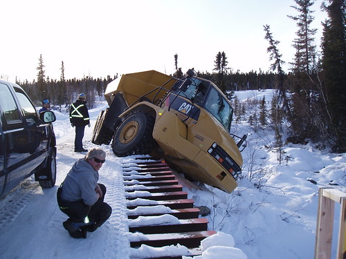
Well that adventure ended rather abruptly just as we (oh, I forgot to mention I had an experienced driver in the truck with me) hit the ice on the return trip to North Inca to collect the second sea-can. As we approached the first portage, the only one with a bridge, we were informed that the bridge was temporally closed due to a CAT 730 rock truck half on half off the bridge. We returned to camp and spent the next hour firing up equipment (no CAA here) to rescue the CAT. While the CAT 325 excavator was warming (still in the -20’s to 30’s here) up we went in for supper and to work out an extraction plan. Supper done, plan formed, time for action and a couple of hours later our 730 was home safe and sound.
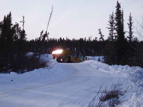
Off the bridge, into the ditch.
Inspection.
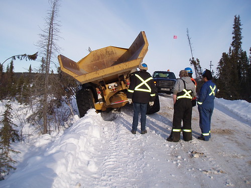
What the Hell happened?
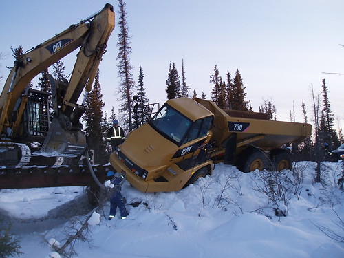
Hooking up.
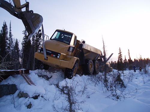
Extraction plan in action.
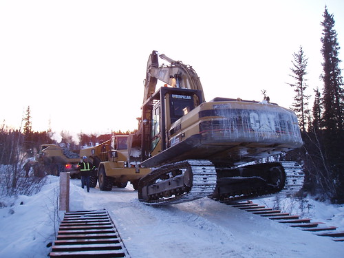
Back on the road again...
Friday started as all other days up do, then down to site to collect the second sea-can and start the rip-rap on the shore line…this is going to take some time as we have only gotten 7 loads placed in 2 days. Distance (42km return) + speed (max. 40km/hr) + weight (half loads) = extra days…the second sea-can was back at Colomac by coffee time, and we were roped into unloading an additional 2 trailers as well as our flatbed. Upon return to North Inca, this time with a rock truck, my classification was upgraded to that of loader operator (something I have not done since my days at GGS, but that’s another story) I was tasked with moving some timbers around until we were reloaded with some concrete to bring back to Colomac. Tomorrow I will start my training as an excavator operator. I’m starting to hope that the rip-rap work takes weeks…..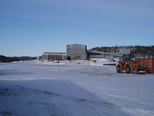
The Colomac Mill. AEL is taking this and other building down this year.
My little bear in training as a equipment operator.
That all for nowCheers
Pat
Back in Colomac...Again...
Wednesday, March 24, 2010, 10:41:32 PM | donkeycat
Monday March 22, 2010
Today I found myself back on the Colomac Mine site.
What an shock…..from “T” shirts and +21C on Saturday before I left to -28C and insulated everything.
It’s been a long time since I have posted anything, so here it is in a nutshell;
Back to how I found myself up here again:
On Friday march 29 (my last day of holiday and while having a visit with my sister, her family and my mom and dad) at 1600hrs I received a voice message from Henry (our man in the north) saying he needed me in Colomac on Monday morning. After a few frantic phone calls to rearrange work schedules (I was going to just outside North Bay for 2 to 3 day on another project also to start on Monday) inform project managers and get another body to cover that work and getting my sister to arrange the flight, I was set to leave on Sunday morning at 0715hrs, meaning 0500hrs at the airport. This was the first time I have ever been through the airport security without having to be searched..WOW what an experience it is to walk through the metal detector and pick up my carry-on bag and jacket and walk down to stand in line for 20 minutes to get a coffee at Tim’s.
Things are not all that different from the last time I was here, the weather is the same (-20 to 30C), the people are the same (same supervisor, crews, office staff and even the ice road cops have half the same crew up here, one was not allowed back as he had 3 accidents on the ice road) the only difference is instead of setting up the site and taking equipment out, we are removing equipment and bags of contaminated soil. The work program this time should be short as most of the ‘stuff’ has been removed.
There is no wildlife to report on, the few caribou that were here left before I arrived. There has been a sighting of a wolverine, and several very big and very healthy wolves and because of the warm weather that was here they did have a bear come out of den and wander to the North Inca site, however all they saw was its tracks.
As I have to borrow a computer to do anything on the internet so I'll be making posts as I can and filling in with photos later.
Well that’s all for now.
Cheers
Pat
Today I found myself back on the Colomac Mine site.
What an shock…..from “T” shirts and +21C on Saturday before I left to -28C and insulated everything.
It’s been a long time since I have posted anything, so here it is in a nutshell;
- We have moved from a small townhouse to a beautiful country estate…well sort of. Actually we are now sitting on 2 acres of land with a 35 year old wood sided house. It needs some TLC but it’s wonderful, and only an extra 10 minutes to work.
- I was working at Ontario Power Generation (OPG) Darlington Nuclear Generation Station (DNGS) with our sister company SENES conducting fish habitat study in the lake and the ford bay. This involved the netting, identification and measurements of fish. I found this to be very interesting and I’m hoping to get involved in more of this type of work.
Back to how I found myself up here again:
On Friday march 29 (my last day of holiday and while having a visit with my sister, her family and my mom and dad) at 1600hrs I received a voice message from Henry (our man in the north) saying he needed me in Colomac on Monday morning. After a few frantic phone calls to rearrange work schedules (I was going to just outside North Bay for 2 to 3 day on another project also to start on Monday) inform project managers and get another body to cover that work and getting my sister to arrange the flight, I was set to leave on Sunday morning at 0715hrs, meaning 0500hrs at the airport. This was the first time I have ever been through the airport security without having to be searched..WOW what an experience it is to walk through the metal detector and pick up my carry-on bag and jacket and walk down to stand in line for 20 minutes to get a coffee at Tim’s.
Things are not all that different from the last time I was here, the weather is the same (-20 to 30C), the people are the same (same supervisor, crews, office staff and even the ice road cops have half the same crew up here, one was not allowed back as he had 3 accidents on the ice road) the only difference is instead of setting up the site and taking equipment out, we are removing equipment and bags of contaminated soil. The work program this time should be short as most of the ‘stuff’ has been removed.
There is no wildlife to report on, the few caribou that were here left before I arrived. There has been a sighting of a wolverine, and several very big and very healthy wolves and because of the warm weather that was here they did have a bear come out of den and wander to the North Inca site, however all they saw was its tracks.
As I have to borrow a computer to do anything on the internet so I'll be making posts as I can and filling in with photos later.
Well that’s all for now.
Cheers
Pat
Up, Up in the air…….
Wednesday, September 16, 2009, 10:51:49 AM | donkeycat
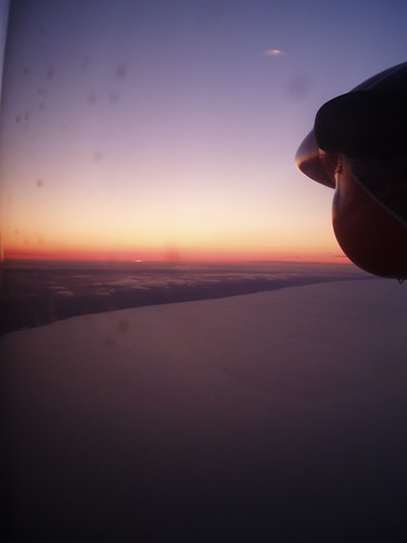
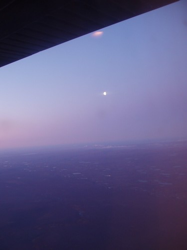
Yesterday was just awesome. The final two sites that I had to visit were done by helicopter. At 0830hrs the phone calls started from the helicopter company, “the weather is not good let’s give it an hour” and hour later “very little change lets see what it looks like in 30 minutes”, “I’ll check in with you at 1100hrs” and finally at 1130hrs I got the call “I’m filing a flight plan, where are we going? And the winds are gusting to 50km with a 600ft ceiling, Do you understand that if we go but cannot complete the work you still have to pay” my answer acknowledged my understanding of the risks and the cost ($1400/hr plus fuel and tax) so at 1310hrs we were in the air. The Bell 206B Jet Ranger is a 4 passenger helicopter with an operation range of about 200 miles, ours was equipped with pontoons as we were crossing water.
My Bell206B Jet Ranger
Cougar’s Sikorsky S-61N Search and Rescue Helicopter.
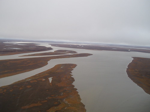
The flight to Pullen Island took 45 minutes because we has to follow to coast because as the pilot explained we must be within gliding distance of shore (can only fly a max. of 25 miles from shore and that depends on altitude, ours was only 600 feet). I did not know that helicopters could glide!!
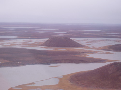
Pingo’s
Where the Mackenzie River meets the Beaufort Sea at Kugmallit Bay.
Pullen Island in located at aprox. N690 46’ 19.3” W1340 24’ 19.3”
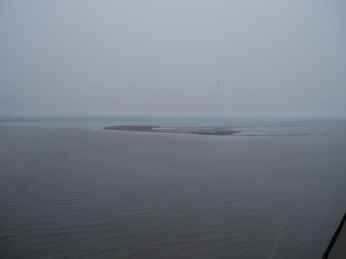
Pullen Island at 4 miles.
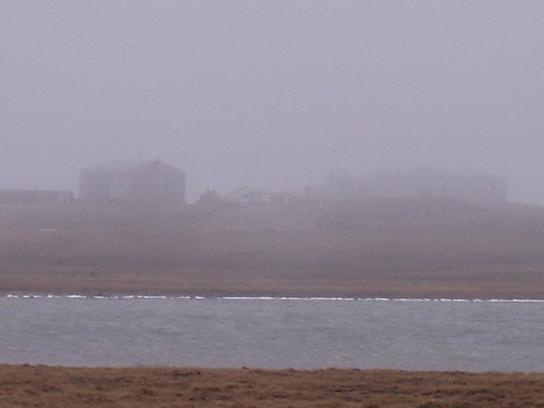
is a small island with a huge erosion problem. The ground cover is typical tundra; however on the North West side the wind, waves and sun are melting the permafrost and that side if the island is sliding into the ocean.
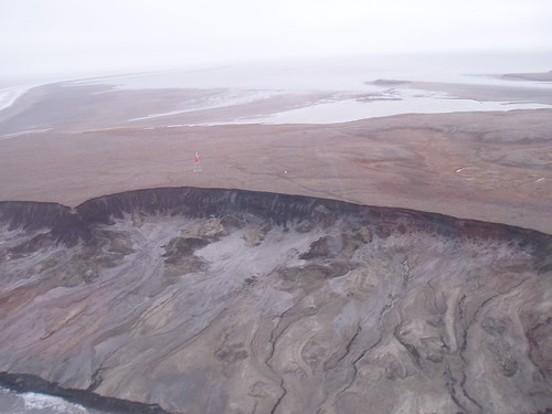
Erosion on a massive scale.
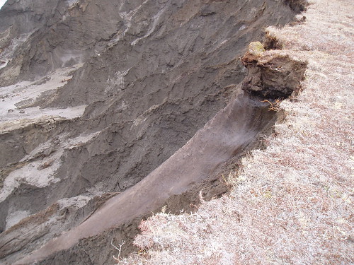
You can see the exposed permafrost and the soil washing away. That’s the range marker in the center.
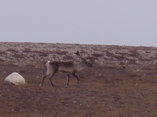
The flight back to Tuk was only 5 minutes shorter and we were flying at 500 ft, very low ceiling. We did manage to see some caribou on the tundra.
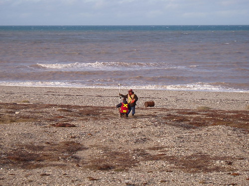
After refueling, locating the next site and amending our flight plan, we were off to the “Field Camp” (aprox N690 34’ 17.2” W1310 17’ 23.3”). This was a site used by DFO for fish and wildlife studies, and is still used by the local hunters in the winter for overnighting while hunting. Upon our arrival the area was occupied by 5 very large caribou bulls, what a magnificent site!
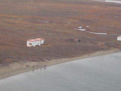
Caribou on the beach at the “Field Camp”.
We worked through the site as quickly as we could, as the evening weather usually brings fog. By 1830hes we were on our way back to Tuk, enroot we saw more caribou, mother and yearling grizzly bears (no photos though, we were flying at 500ft and did not want to go lower and stress these magnificent creatures any more than they were) and flocks of snow and Canada geese.
All that remained to do was finish a few reports and get the samples ready for shipping and that took all day.
Cheers
Pat
Fogged in, in Tuk
Monday, September 14, 2009, 8:47:59 AM | donkeycat
What a day…..stuck in the camp doing paper work (actually computer work).
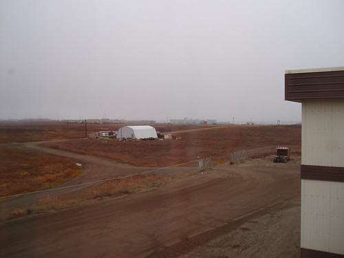
The fog this morning was so heavy you could see just across the road. No flights in or out today.
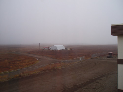
This afternoon at 1730hrs, you can see the fog has pulled back.
I did manage to talk to the people at Canadian Helicopter and make arrangements to get a Bell 206B Jet Ranger for tomorrow. Dale and I will be heading off to Pullen Island, About 60km north of Tuk and Eskimo Lake about 70km east of Tuk, that is if the weather breaks.
As I was doing some computer stuff and half listing to the TV in the background, I heard them talking about Gruben’s Camp in Tuk, I turned to find the show was ‘Ice Road Truckers” and they were saying that they were carring "TOP SECRET" loads from an old military base, and that they were not told what ther were carring. By the looks of it they were carring wooden boxes with either contaminated soil or hazardous (PCB or Lead painted wood) material, that would be my guess. After a few minutes of that, I switched it over to CSI, then turned off the TV.
Aside from that there is nothing to write about.
Aside from that there is nothing to write about.
Cheers
Pat
Kept very busy…
Saturday, September 12, 2009, 9:49:52 PM | donkeycat
The last two days have been very busy for me…I have not have not had time to blog.
Yesterday was just beautiful, we had an amazing sun rise,
Sunrise over Tuk Bay.
and the boating on the bay was easy except for the wind,
Heading out on Tuk Bay.
My guide Dale Panakatlok, he's and experianced harvester and has been on the land since he was 7.
He has a seven year old son and he is learning the way of the land, he has already trapped a beaver.
A view of Tuk from the bay.
however we missed it when we headed inland. Bugs, bugs, bugs, all blackflys, but up they call them bulldogs and they will drive the caribou (and everything else) to the sea. The tundra is very difficult to walk on, it is not level, it’s full of holes, the dwarf willows tangle together and although you can see over them getting through them is another matter. The days are cool to cold but the sun up here is very intense. You may need a have jacket to go walking outside but get behind a hill and out of the wind and its t-shirt time.
Here are one of the ranges (if you are a sailor you will recognize these) I am here to inspect.
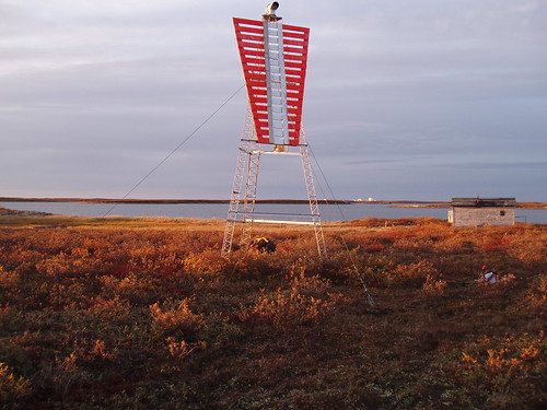
A typical range marker. They are used to bring ships into the harbour or channel. This is done by lining the front range up with the back range
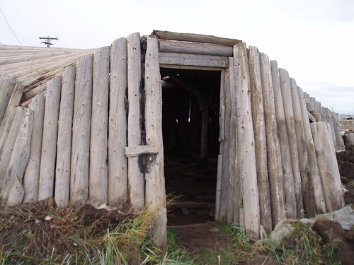
An ice house. the drift wood is covered in peat, the permafrost moves up into the peat and keeps everything inside frozen.
Today we had a heavy fog all morning (good thing we had finish the work across the bay) we could hear the plane but could not see him, after about 20 minutes circling the town he was gone, likely back to Inuvik where he came from.
The Gruben's Tuk Base Camp in the fog, from the bay.
At the camp that I am staying there is a helicopter search and rescue crew (that is all retired sartech) they are working for BP and they are on a 3in 3 out rotation until the end of October, just incase the drill rigs need them. most are from the rock
That’s all for now
Cheers
Pat
Stuck in Tuk…..
Thursday, September 10, 2009, 8:45:38 PM | donkeycat
Well last night I was plucked from my site at PIN-B and dropped in Tuktoyaktuk with little information on the project I am to work on. I have been left to my own devices to make arrangement for boats, guides, to figure out what I have and what I will need in the way of supplies and equipment and the chopper,(well that’s another story, at $1400 an hour I do not have room on my credit card to cover this!) and all this has to be done by the 16 of September, when I will be flying home.
The project work has more than doubled since I left Richmond Hill. What was 5 soil samples per site has now become 15 plus. My sample jars are lost in the world of air shipping and my equipment is in the “capable hands” of UPS.
There are no hotels in Tuk so I’m staying at the Gruben’s base camp…wow what a place there must be 200 rooms, (I have my own with a kitchen, unlike some of my other stays in the arctic) a movie theater, a gym and a dining room and you get all of this for $400.00 a night. The down side is it’s on the outside of town and I have no mode of transportation. Dinner tonight was Cod-Au-Gratin (not as good as my Shelly makes), turnip and chicken.
I spent the day sorting through e-mails trying to figure out what I am suppose to do here and how to get it done, in the afternoon I was out on the bay with my guide and boat operator (Dale) checking out the DFO markers. We even started the sampling program; however it was cut short because we broke the handle on the shovel. Tomorrow we hope to have better luck. (I hate these thrown together jobs)
A little information on Tuk.
Located on the shores of the Arctic Ocean, near the Mackenzie River Delta at 69°27'N and 133°02'W, 137 km north of Inuvik and 1130 km northwest of Yellowknife. It is the most northerly community on mainland Canada. Tuktoyaktuk, or Tuktuyaaqtuuq is the anglicized form of the native Inuvialuit place-name, meaning "resembling a caribou." According to legend, a woman looked on as some caribou, common at the site, waded into the water and turned into stone, or became petrified. Today, reefs resembling these petrified caribou are said to be visible at low tide along the shore of the town.
Tuktoyaktuk is the gateway for Pingo National Landmark, an area protecting eight nearby pingos in a region which contains approximately 1,350 of these Arctic ice-dome hills. The landmark comprises an area roughly 16 km2 (6.2 sq mi), just a few miles west of the community, and includes Canada's highest (the world's second-highest) pingo, at 49 m (160 ft). It is managed by Parks Canada within the national park system, and, although a nationwide Landmarks program was envisioned, Pingo remains the country's only National Landmark. I hope to have some time to see them.
What is a Pingo you ask…well a pingo, also called a hydrolaccolith, is a mound of earth-covered ice found in the Arctic and subarctic that can reach up to 70 metres (230 ft) in height and up to 600 m (2,000 ft) in diameter. The term originated as the Inuvialuktun word for a small hill. A pingo is a periglacial landform, which is defined as a nonglacial landform or process linked to colder climates. They are essentially formed by ground ice which develops during the winter months as temperatures fall.
The night view heading into Tuk,
Sun set in front of the plane.
Moon rise in to the back.
Cheers
Pat
For Thomas.......
Tuesday, September 08, 2009, 2:37:42 PM | donkeycat
Our site all fogged in..
Our Tuktuk (caribou)

Cheers
Dad
Dad
Small footprint camp fire…..
Monday, September 07, 2009, 8:51:57 PM | donkeycat
I had been doing some reading on small footprint camping and found some interesting stuff.
I found a web site that offered a how-to for a “Ammo can, BBQ” the site is http://www.therangerdigest.com/ and look under B-B-Q AMMO CANS. The site is owned by Ranger Rick F.Tscherne (Retired) and has all kinds of great tips for the outdoors.
I also looked up the Kelly Kettle (which I always carry with me when in the woods) web site at http://www.kellykettle.com to check out some of their ideas on efficient use of available fuel and how to contain the fire.
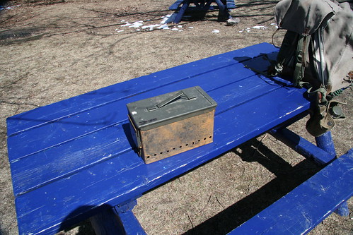
Then I combined the idea of the ammo-can BBQ (easy to make and a price that was right) with the fuel efficiency (anything, wood or grass to pinecones, etc) and the contained fire idea of the Kelly Kettle and came up with the ammo-can fire pit/stove.
I’m sure that I am not the only one out there that has made one of these, and I’m not claiming that I came up with the idea; this is just my version of it.
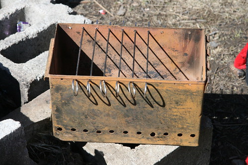
I drilled ten ½” diameter holes along both sides 1” above the bottom of the can and a 2” diameter hole in one end (to feed in the fuel) and ten 3/16” diameter holes along the top to put the skewers through (they would form the grill).
I use six stainless steel skewers cut to 1” longer than the width of the ammo-can and with the ten holes across the top I am able to make the grill as wide or as narrow as I need. Also they can be used as skewers to cook a shish-kabob if so desired.
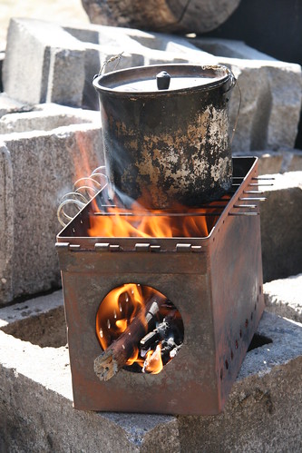
The ammo-can in its travel mode currently carries my 1 liter Billy-Can (inside the Billy-Can, I carry tea bags, sugar, fire making kit, Montreal steak spice, a can of milk) two cups, the skewers and hotdogs or something else to eat as well as my leather gloves.
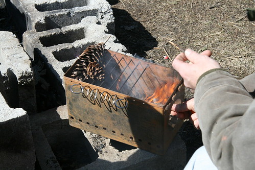
The ammo-can stove will boil 1 liter of water in 3 to 5 minutes depending on the type of fuel that is used, I usually use dead twigs and small branched (nothing bigger than the diameter of my thumb) and a little birch bark to get it going.
The ammo-can stove will boil 1 liter of water in 3 to 5 minutes depending on the type of fuel that is used, I usually use dead twigs and small branched (nothing bigger than the diameter of my thumb) and a little birch bark to get it going.
Because of the shape of the ammo-can (the heat is always redirected inward and up) and the small diameter of the fuel the fire burns hot, fast and clean and there is very little ash left and after the fire is finished the ammo-can cools down very quickly, so cleaning up and packing up is fast.
With the ammo-can stove perched on a couple of flat rocks there is no scorching of the earth below and because the fire is contained in the steel ammo-can it works well in wet or snow covered ground conditions. DO NOT USE INDOORS!

Cheers
Pat
Pat
Magic and superstition?
Monday, September 07, 2009, 11:02:48 AM | donkeycat
Well nothing exciting has been happening here at PIN-B since my last entry. The construction of the landfill is going well and the removal of the hazardous material (asbestos and lead/PCB paint) is going although very slowly as we are having to do training at the same time.
There are several areas of historical/archaeological interest as well as the site itself.
Inuit tent rings.
Detirick our wildlife monitor found this meat cache not far form our camp.
Old freight ship once used to trade for furs along the gulf coast.
And then there is the land…to me it is breathtaking, I can look at it every day in amazement. The way the land , sea and sky come together as one…and the sunsets and night sky , well you have to see it to believe it.
There are three caribou that are hanging around our camp, I thought this was a little strange as most of the herds have started heading south. I was asking our wildlife monitor, Detirick, about it and he responded with “they are the sprits”. The puzzled look on my face must have been obvious because he went on to explain that the spirits are keeping the good animals near so that we know the camp is safe from the bad animals. We have found grizzly bear tracks (8 to 9” wide, or as Detirick said size 91/2 boot) down at the beach head (over a 1.5km from camp) but no one has seen the bear since the caribou showed up. Magic and superstition? I do believe that we need to be more in touch with the natural world and listen to our surroundings. Anyhow I am glad to have the spirits here as we have no bear fence at this camp.
Our spirit guardian.
Cheers from on the Amundsen Gulf.
Pat
Strange sites in the north….
Friday, September 04, 2009, 10:06:24 PM | donkeycat
Thursday was a very interesting day. We woke to find a ship anchored off the beach and several zodiacs racing to our beachhead. It looked like an invasion task force. As we emerged from our morning meeting about 30 minutes later we saw a series of yellow ribbons heading from the beach to our site.
Off we went to investigate….it turned out to be a tour group from the ship Akademik Ioffee returning from the Beaufort Sea to Cambridge Bay Nunavut. Just over one hundred yellow jacketed tourists were being led on a walking tour by Michael Richardson of Quark Expeditions to our work site. It seams that one of the passengers on the ship had spent some time on the site conducting geological surveys of the area and thought it would be interesting for all to see.
As no remedial work was in progress and under the conditions that no one enters any of the structures (work and/or camp) and they do not interfere with the daily operations of the site we allowed them access to the site. They had several questions about the work (What are you doing here?, Do you live on the site or travel here each day?, are there any wild animals here? And How long are you going to be here?) And then off they went to photograph the site in detail. (I thought I took some detailed photos but these people were at every building from every angle)
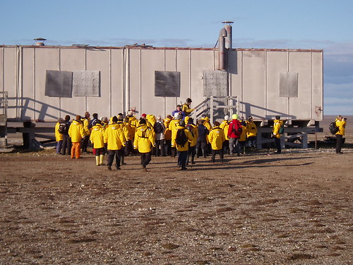
The web site for Quark is http://www.quarkexpeditions.com/our-fleet/overview). All visitors were off the site by 1000hrs and we were able to get back to the tasks at hand, namely getting ready for the arrival of our supply planes. The first plane brought in the supplies that were left in Yellowknife the day I came to site as well as other necessities. The second plane (actually the same plane second run) brought in our work crews, heavy equipment operators and Haz-Mat workers. After getting their gear stowed we sat down to a two hour site orientation meeting, which explained the; what’s, where’s and how’s of the site, it was dinner time (2000hrs, I think that is the continental dinning hour) and then for me it was report time.
The web site for Quark is http://www.quarkexpeditions.com/our-fleet/overview). All visitors were off the site by 1000hrs and we were able to get back to the tasks at hand, namely getting ready for the arrival of our supply planes. The first plane brought in the supplies that were left in Yellowknife the day I came to site as well as other necessities. The second plane (actually the same plane second run) brought in our work crews, heavy equipment operators and Haz-Mat workers. After getting their gear stowed we sat down to a two hour site orientation meeting, which explained the; what’s, where’s and how’s of the site, it was dinner time (2000hrs, I think that is the continental dinning hour) and then for me it was report time.
Friday started off with a beautiful sun rise......
but as the day progressed the weather digressed. The sky clouded over and the wind picked up, it could be a cold night. Anyhow………
Our surveyors on the beach.
We found out that our Haz-Mat crew has had no training on the removal of hazardous material and none of them has ever worn a respirator before. This presents a whole new challenge for the contractor. Before we can start the cleanup of the site we need to train the staff. They are a good bunch and seam eager to learn and work. After a morning of indoctrination into the world of asbestos, we set them to work on one of the smaller buildings with a minor asbestos removal requirement.
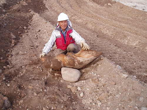
Our HEO’s would be retired in any other part of the world, they are a little slow now but they have a lot of experience in operating heavy equipment and in a few days they will be up to speed. Charley Hinanik, our CAT D6R dozer operator, uncovered a whale bone in one of our borrow pits. The unusual thing about this is the pit is about 500m from the waters edge. We will place it off to the side and protect it.
As for me, after working with the contractor conducting the training program for the Haz-Mat crew, I settled down into reading the spec’s for this project, completing some reports, set up my printer (and yes I did it all by myself) and then dug into the proposal for the work that I will be doing in Tuktoyaktuk, Summers Harbour and Sachs Harbour, after dinner I’ll be reading some older reports that were written about PIN-B.
Well that’s all for now
Cheers
Pat
First full day on site…..
Wednesday, September 02, 2009, 10:21:03 PM | donkeycat
It was absolutely beautiful here today, it started off a little on the cool side (60C with a light wind) but by 1000hrs it had warmed up to 120C and no wind with a clear blue sky. It should go down to 3 tonight.
I spent most of the day photographing the site and collecting samples (asbestos and soil) and even got a few shots of the local wildlife.
Some photos of the site.
The Garage.
The warehouse.
The modular train (this was the station)
The Inuit house (this is where the native workers on the station would have lived)
A burial mount, of historic value and to be protected.
Some of the wild and plant life on site.
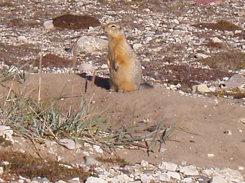
A sic-sic (ground squirrel)
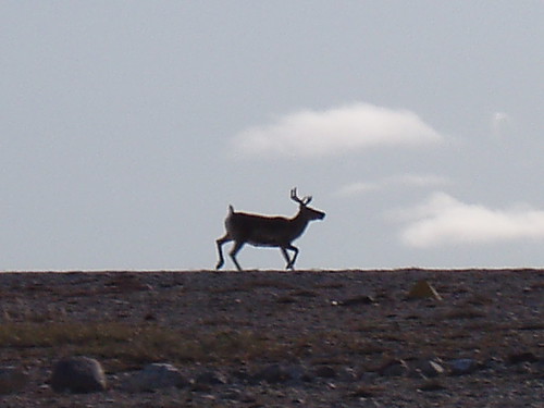
A tuktuk (caribou)
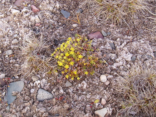
Arctic poppy (I believe)
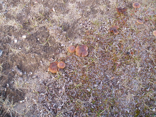
Arctic mushrooms
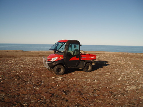
Oh by the way I have down sized from my Ford F250….

to the 4x4 version of a smart car the Kubota RTV1100.
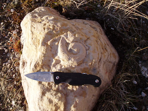
And for Shelly..do you know what is it?
Well that’s it for today
Cheers
Pat
On site at PIN-B
Tuesday, September 01, 2009, 11:30:00 PM | donkeycat
Well we got off to a great start…our flight was delayed by two hours because we had to wait for some plumbing supplies and a hot water heater. These items put us over the weight limit for the twin otter, so they unloaded the frozen food and dry goods.
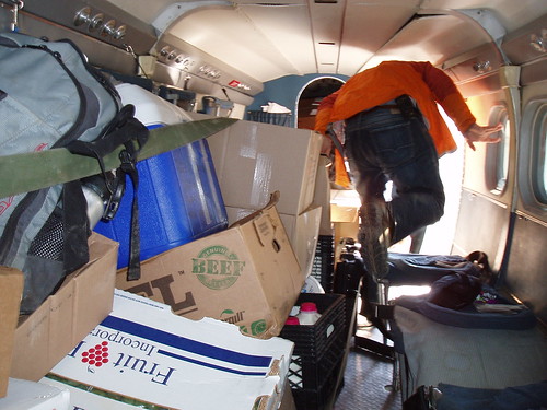
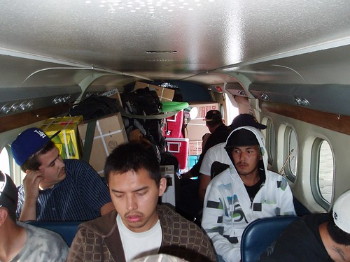
Inside the twin otter.
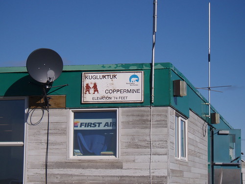
The flight from Yellowknife was 2hrs 45min to our refueling point in the town of Kugluktuk (formerly known as Coppermine).
Ten minutes of refueling and we were back in the air. The second leg of our trip was 50min flying time to PIN-B.
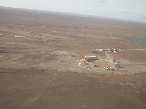
PIN-B from the air.
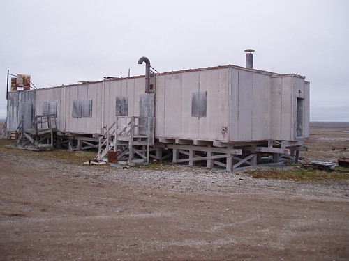
The camp is still being setup, the cook and housekeeping staffs arrived yesterday and are still sorting through boxes and taking inventory, the phones and internet were still being setup as we arrived and were not fully functional for another 3 hours (much to the dismay of the pilots, who had hoped to be back in the air after lunch). The setup I have is very different from the sites I have worked on in the past; here I have my own trailer with sleeping quarters and office and also my own soils lab, although it is missing all the equipment that a soils lab needs to be called a lab.

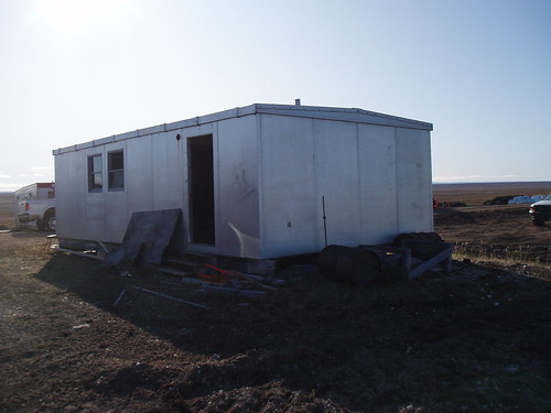
my new office, sleeping quarters in the back.
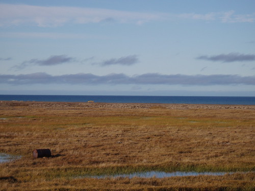
the arctic ocean across the tundra.
Well its 2200hrs here and it’s been a long day and I still have specs. to read so I’ll end it here.
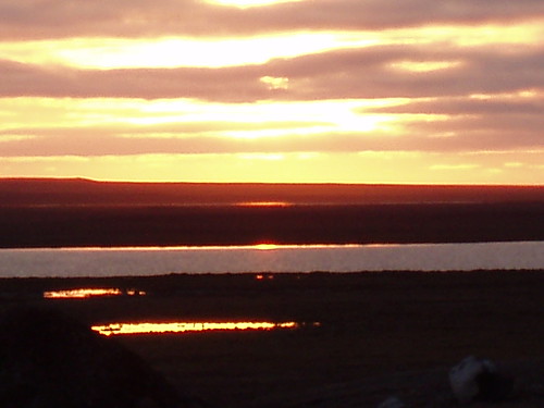
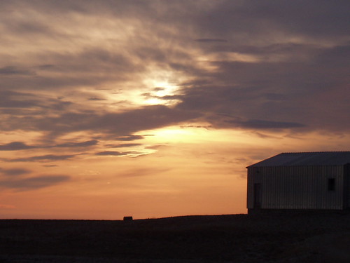
Sunset from the camp.
Cheers and goodnight
Pat
Going North…..
Monday, August 31, 2009, 9:49:12 PM | donkeycat
Well here I am in Yellowknife again. I’ve been here since Saturday waiting for my flight to PIN-B. Monday’s flight was called off due to bad weather on the arctic costs, strong wind and fog.
My time here in town has not gone to waste, we got the go-ahead for another government project to conduct assessments on several DFO sites throughout the Northwest Territories and I have spent the last two day working on the Yellowknife Wharf. This project will continue for me after the PIN-B work and will take me to Tuktoyaktuk for assessment of several sites in the Arctic Ocean, and then to north of 70 to Sachs Harbor.
Well I have to go and pack as I have been informed that the flight to PIN-B will take place on Tuesday morning.
Cheers
Pat
Not Skunked….
Friday, August 28, 2009, 8:09:42 PM | donkeycat
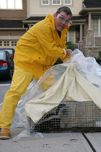
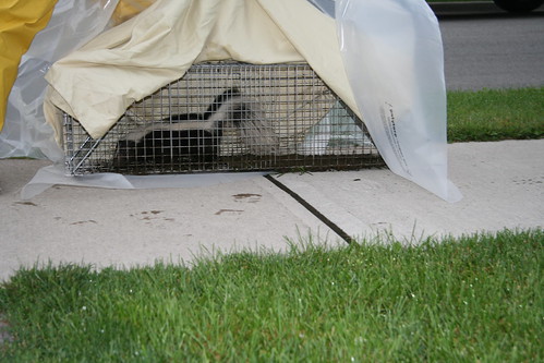
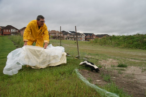
We have been having trouble with raccoons pulling up the grass in our back yard looking for white grubs (as we have sold the house it is important to keep the lawn looking good). So last Saturday night Thomas and I set several traps to catch the invaders. I have used the live traps to catch and relocate squirrels that had taken up residence in the attic and basements of houses owned by friends; however this is the first time I have gone after something as large as a raccoon.
The traps were set, Thomas had gone to bed and Shelly and I were just retiring for the night (at 2230hrs) when we heard the snap of the trap doors. We raced to the kitchen to check on our captive and to our surprise it was not a raccoon as we had hoped but a skunk. We left him to spend the night behind bars and went to bed wondering what to do with this catch.
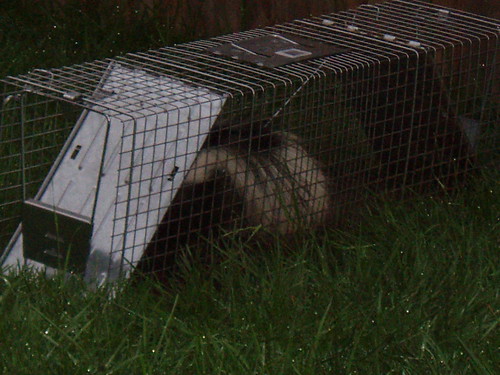
At 0700hrs the next morning we attacked the problem with me dressed in my rain suite, rubber lab gloves and a pair of safety glasses, while Shelly, Thomas and the neighbor stayed back a safe distance with the camera. A tarp was placed over the trap and the small skunk was taken to the park (several blocks away) and set free. There was no harm done to the animal and I was not skunked…a good day for all.
Cheers
Pat
Have a good journey and safe home!
Friday, August 28, 2009, 7:28:20 AM | donkeycat
I received an e-mail from a friend, Chuck, who has been sent to Mumbai, India on a four month project. He will be keeping a blog detailing his adventures. The blog site is the Vindaloo Times found at http://csassaf.wordpress.com.
I want him to know that I am green with envy that he gets to go to some warm exotic place, while I get sent to an arctic outpost at the edge of the world in the fall.
Chuck, I’ll, be checking into your blog every chance I get.
Cheers
Pat
Heading North Again….
Friday, August 28, 2009, 7:12:10 AM | donkeycat
Look up, way up..to the top of the globe…..
I’m heading north again, this time to work on an abandoned DEW Line site in Nunavut.
The PIN-B, Clifton Point site is located on the Amundsen Gulf Coast in Nunavut (690 12’N, 1180 37’W). The nearest communities are Paulatuk 220km to the northwest and Kugluktuk approximately 220km to the south east.
A little background on the DEW Line….
Taken from web site http://www.lswilson.ca/dewline.htm
“The Distant Early Warning (DEW) Line began on 15 February 1954 when President Eisenhower signed the bill approving the construction. It, was designed and built during the "Cold War" as the primary line of air defense warning of "Over the Pole" invasion of the North American Continent.
The actual construction of the 58 sites took place between 1955 and 1957. Many tons of supplies and equipment were moved to the Arctic by air, sea and river barge. One such carrier, the USAF 62nd Airlift Wing, moved over 13 million pounds of materiel in this monumental effort. The DEW Line was declared fully operational on 31 Jul 1957, (ref: USAF Museum "This week in Airforce History), and remained in operation for better than 30 years.”
For more information on DEW Line Radar Sites click on the above site.
What I’ll be doing at PIN-B…
The work at this site involves the cleanup of soil impacted with metals, PCB’s, hydrocarbon, buried dump sites, drums, strip the building of asbestos and lead and mercury paint, and build a non-hazardous material landfill site. However before the work can begin we (that is the contractor needs to land a barge carrying a camp, equipment and supplies and perform maintenance on the airstrip and roads. From the correspondence I have received the barge will be landing on Friday or Saturday and I will be landing on Monday.
A report from the north said that the barge was having trouble landing, one of the bays was full of ice? and the winds were to strong for a landing at the other bay.
Lets hope that the camp arrives!
Cheers
Pat
Northward Bound
Wednesday, August 12, 2009, 6:42:25 PM | donkeycat
I thought that I would not be getting any work up north this year….
Well here I am in northern Ontario, about an hours drive from Sudbury in a small town called Levack at a mine site. This time instead of decommissioning and closing the mine I am involved in the construction of a ‘waste rock containment pad’ at an operating mine.
The work is not as interesting as closing a mine, however the location is just as bad. I’m staying in a hotel about 30 minutes drive from the site. The room is fine and sleeping is easy once you get use to the constant truck traffic and the freight train whistle. The restaurant serves a good breakfast but tonight I found out that ‘Montreal steak spice’ can make a boot sole taste like steak.
I have two weeks to serve in this purgatory before I return home and get my next posting.
I’ll report if there is anything to report on….
Cheers
Pat
Scotch Bonnet Lighthouse
Sunday, August 09, 2009, 1:41:40 PM | donkeycat
It seams that my work in the north has been put on hold for this season, which means that I’ll be spending more time at home in Ontario, which is O.K. as we will be moving to the country side come the end of September.
This summer has kept me busy conducting the usual environmental investigations and cleanups, geotechnical inspections and more involvement in the biology side (gill netting fish on Lake Ontario at Darlington Nuclear Power Plant) of the environmental field.
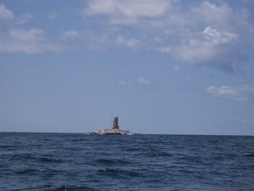
One of the more interesting projects of the season was an inspection and assessment on a lighthouse on Lake Ontario. After a three hour drive from Newmarket to Wellington Ontario, the only public boat launch in the area, we put our boat (a 14ft deep “V” aluminum with a 15hp motor) into the water for the 17.5km journey to Scotch Bonnet Island. The day was clear and bright with a light breeze and calm water according to Environment Canada’s weather service. It seamed that the farther we got from the protection of the marina the larger the waves got. We spent the better part of the 1 hour 45 minute trip to the island fighting 3ft waves. The next challenge we faced was how to land ashore. The island has no docking facilities and is surrounded by an algae covered rock ledge, this coupled with the wave action made it near impossible to land. I was glad to have Dano, a good friend and excellent small craft captain, with me as his experience in handling the small boat in rough water was invaluable. After circling the island a couple of times we finally made a landing attempt. Dano brought the boat in alongside the rock ledge on the east side on the island and held it there long enough for me to jump out with my gear. He then pulled back from the rocks and waited until I had finished my work. As I worked and he circled the island the sky darkened, the wind picked up and the waves grew in size from 3 to 5ft. I was working as fast as I could and over the roar of the waves I could hear his words of encouragement “take all the time you need, but hurry”. After two hours on this bird covered, flee infested, wind swept rock it was time to go, now all I had to do was get back into the boat! Thinking of the trouble I had getting on the island and the change in the weather, I thought for sure I was going for a swim, again Dano’s skill at the tiller put the boat to where I could throw my equipment and myself in. The trip back to the marina was exciting and unnerving at the same time, there were several times that we thought the boat was going over. We docked at the marina safely with but a small ding in the prop as our only damage.
Here is a little on the lighthouse..
Scotch Bonnet Lighthouse, located offshore to the west of Prince Edward County, is located on Scotch Bonnet Island (0.8 hectares in size) - 3.5 miles SW of Huyck Point and only seven feet above water level. The island is approximately 0.9 miles southwest of Nicholson Island. The original lighthouse was built of limestone, brought from shore to mark the island in 1856.
The original lighthouse was characterized by a conical stone tower having a height of 54 feet, the height of focal plane was 51 feet and the range was a fixed white, visible for 12 miles. Attached to the tower was a keepers house.
The lighthouse had six keepers between the years 1856 and 1912 (John Giroux or Gerow (1856-1868), Henry Van Dusen and Wilson Bentley (1868-1878), Robert Pye (1878-1898) "It is on the record that during Robert Pye's stay at the Scotch Bonnet light station, eleven lamps were used, seventy seven wicks were burned and one hundred and twenty gallons of oil. This was during one season due to seas and gales breaking the lighthouse windows." , D.O. Spencer (1898-1903), Cyril Spencer (1903-1912) and B.Y. Cunningham (last keeper) (1912))
In 1909 the light was replaced with an acetylene gas "vapor light". In 1912, the light was automated and became occulting rather than fixed; 1933 it is reported as occulting one second in every four; in 1948 it is reported as flashing white.
In 1959 a 70 foot above water (60ft high steel skeleton) tower was built and managed by the Canadian Coast Guard.
Abandoned since 1959 the lighthouse keepers residence was still fairly obvious [1994], but the stone tower and attached residence are little more than ruins.
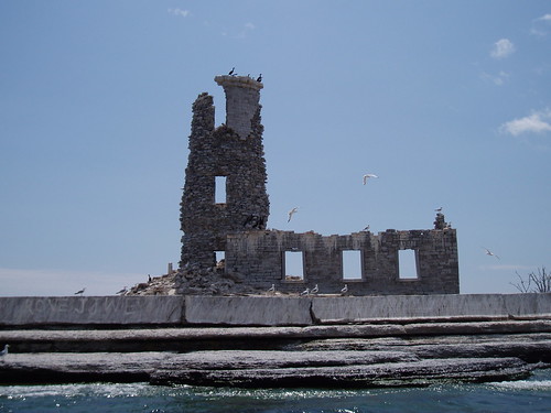
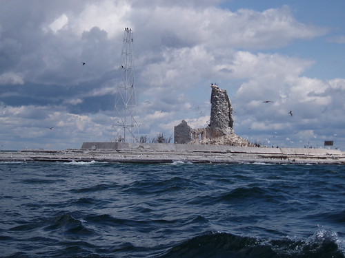
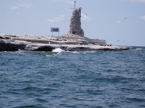
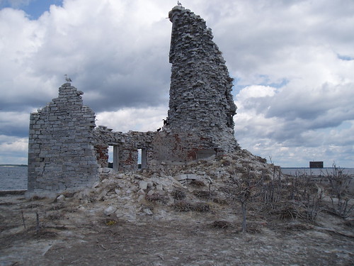
The Department of Transport transferred Scotch Bonnet Island to the Canadian Wildlife Service to protect the wildlife habitat as a National Wildlife Area (1978).
Today the Island is an important nesting site for colonial birds, which nest in large groups (colonies) for protection. The nesting grounds are important for colonial birds because the island provides refuge from predators for the young nestlings. Gulls and cormorants nest and loaf on the island. During spring and autumn migration, other birds such as Black-crowned Night Herons and shorebirds pass through and use the island.
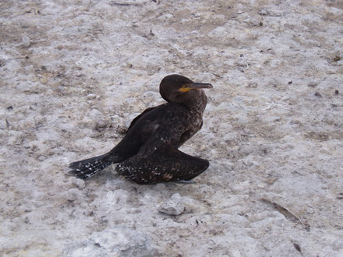
A young cormorant.
Scotch Bonnet Island (like Mohawk Island) is one of the sites in the Great Lakes that are visited each year as part of a long-term study. In the early 1970s, the Canadian Wildlife Service began to monitor persistent (lasting) toxic chemicals in the eggs of Herring Gulls. The study continues today, more than three decades later.
Visits to Scotch Bonnet Island are not encouraged because it has been set aside to protect nesting birds from disturbance. No visits are permitted during nesting season (April 1 to July 31). Birdwatchers who wish to approach the site at other times must be extremely careful because there are many submerged rocks and shoals surrounding the island.
Read about the study at:
Some very good air photos can be seen at :
The arrival of my first grandson!
Thursday, July 30, 2009, 7:46:12 PM | donkeycat
A Very Good Morning To All;
I am extremely pleased to announce that as of 0053hrs today I became a grandfather!
My son James and his partner Rebecca delivered into this world an 8lb 11oz, 22” long baby boy by the name of Sheamus Luke.

All three are doing fine and resting today!
Cheers
Pat Shodan Test
Monday, May 04, 2009, 7:29:51 PM | donkeycat
I have been studying Uechi Ryu Karate since the mid 1990’s and on Friday May 1, 2009 I had my Shodan Test at Cold Mountain in Toronto (www.coldmountain.ca). I was one of eight people being tested that night, and the lowest rank (2 Yondan, a Sandan. 2 Nidan, and 2 Shodan and myself a Ikkyu).
I was very surprised and greatly honored to see all my fellow students from The Uechi-Ryu Karate Academy in Bradford in attendance, as well as some very good friends (also Uechi Ryu students) who had driven in from Nipigon (about 30hrs driving round trip) and from Ottawa, and as always Shelly was by my side.
Attached is a home made video of my piece of the test (about 20min. running time).
Not posted yet, I'm having trouble attaching the video.
Not posted yet, I'm having trouble attaching the video.
The test starts off with Sanchin Focus Testing. This is done to test the physical condition of the body as well as the Sanchin stance and the focus of the person being graded (me). Next is the Kote Kotei, that is an arm rubbing exercise that promotes correct posture, balance, stability, and foundation. As a basic exercise it prepares the arm for conditioning. Next is the demonstration of my high kata Seisan followed by the application of the kata. Then Dan Kumite, a series of prearranged sparing routines. Followed by free style sparring. And finally my presentation on my understanding of what I’ve been studying. This is a personalized question that is given to each candidate.
Cheers
Pat
My last day on site.
Monday, April 06, 2009, 1:30:31 PM | donkeycat
April 6th 2009
Just some photos of the land and such.

Powdered milk in a wooden cask?
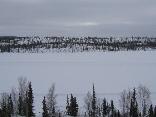
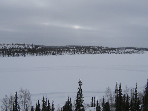
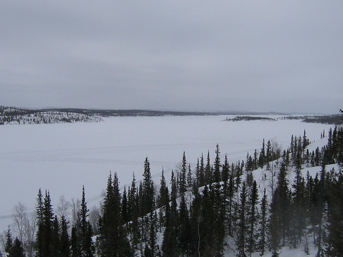
Until the summer….
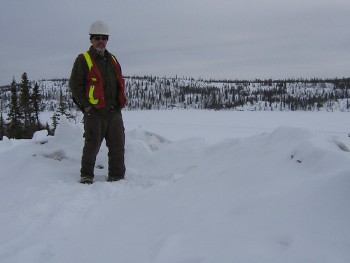
Cheers
Pat
Another day gone bye..
Monday, April 06, 2009, 12:50:04 PM | donkeycat
April 5.2009….one more sleep till Yellowknife.
There is nothing much to report on today. The temperature was -12C in the morning and got up to +5C in the afternoon. It sounds great, days are getting warmer spring is here, however the warm weather makes the site more dangerous. The roads ice up making the driving dangerous and the snow and ice start to come off the roof. No slamming doors and always keep a look out when entering any building.
Work on site continued as planned with the demolition of the outhouse at the camp site and the one at the manager’s cabin and the moving of supplies to site for the summer program.
In the afternoon Ford and I took a four wheeling trip down to the tailings dams. We did have some trouble getting up some of the hills as they are very slick. I got the story of the worker that died at the tailings pond. He was the health and safety officer for the Colomac site (and the crew had finished doing some work on the frozen core dams at the end of the lake and had just left for camp) and we went onto the ice to get some close up photos of the caribou heard at the north end of the lake when he did not return to camp the search party was sent out and found him. He had gone through the ice not more that 70 feet from his truck.
There had been some type of fertilizer put into the lake (I don’t know the reason or by who or when) and it keeps releasing nitrogen which does not allow the ice to thicken making it very dangerous.
Time to go and pack up.
Cheers
Pat
The opening of a new month….April 1st 2009
Monday, April 06, 2009, 9:34:08 AM | donkeycat
Well surprise, surprise, surprise..my work term up here has been extended to the end of the month…just kidding April’s fools.
Five more sleeps until they let me out. Today was another fine day on site. Who would have thought -280C could be so beautiful.
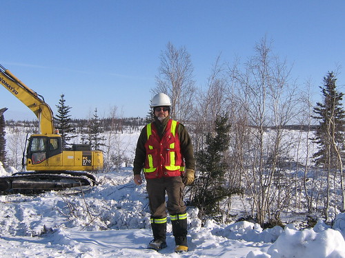
That's me on the mine site, -28 and only a fleece.
We still have 40-44” of ice on Indin Lake, so there is lots of ice for our trucks and tractor trailers to travel on.
I had to move and count drums today…not even as exciting as counting trucks, at least trucks move…so far we have pulled from the woods 142 drums using sled and rope. These drums have been taken back to Colomac and will be crushed and land filled. The fire is still burning strong and will likely be kept that way for the rest of the week. The plan is to burn all the structures that we can during the winter program, before we need a burn permit.
I mapped out the ice road that we take to work every day, however there are to many GPS points to type them all out (with the way I type we will have completed the summer program by the time I finish entering them) so I included a photo of the proposed and the actual road layout with the portage numbers.
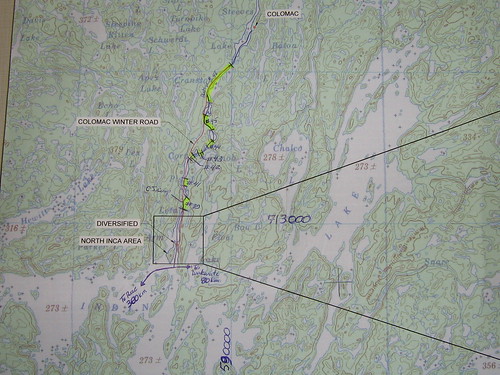
Well I have to get some work done (report writing).
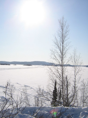
Unexpected Enchantment
by Jonathan Robin
Enchantment of soft wonder vision sent
as Spring sun sudden melting Winter’s snow –
yet warmer – only tenderness should show
sweet nothings conjured to presentiment
that sing heart’s harp strings, harvest sentiment
to garner unexpected harvest glow.
But this rings platitudinous for so
especial shines one smile, one spirit bent
on gifting more than moment’s monument,
transparency between twin souls clears flow
beyond horizons most are wont to know
encouraging souls' shared enlightenment.
This sonnet leaves beginnings, weaves true end
which, rich, gilds Time itself to time extend...
© Jonathan Robin Poem written 16 October 1990
Third version of the poem, whose previous title was Enchantment, copyright 19 October 2008
Posted with the consent of the copyright holder Jonathan Robin.
Cheers
Pat
April 4..Two more sleeps till the plane home..
Sunday, April 05, 2009, 9:45:23 AM | donkeycat
Today was a good day! The weather was perfect -20 in the morning but by 1000hrs it was up to -12 with a high of -8 for the day.
We kept on burning the scrap wood at the mine site and started on some of the out buildings. The radio shack was the first to go. We were not allowed to burn-in-place, so the structure was cut into manageable pieces and burned in a pit that was dug in the snow. The fire was easy to get going (John..I did it with one match) and it burned for 8 hours. We then took apart the mine site outhouse, however we took this across the site to the burn pan. Fire up here is always a concern, even in the winter. If one breaks out there is no where to go and you have to wait for someone to get you out. This will be the biggest concern for the summer program, that is why there is a push to burn now while the snow is deep.
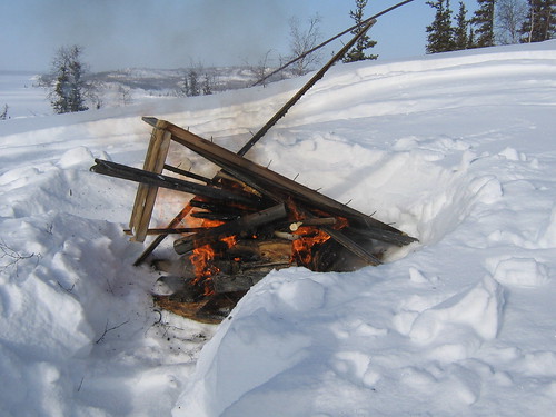
Radio shack fire.
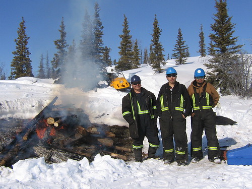
Our crew - Larry, Jerry and Brodie.
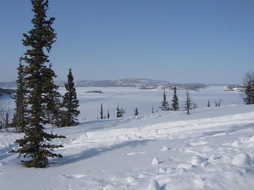
View of the land from the top of the hill.
I met up with a friend of mine today who was out caribou hunting. Just after lunch a truck showed up at our site asking for Ford and to borrow a saw to cut fire wood. Ford and I loaded the truck with wood from the site and took a drive up the Wakwati road to find Bob and the rest of his group. His hunting party was made up of his wife, two young sons, an aunt and two girls from Yellowknife (original from Vancouver and they have never been on a hunt before). They had four caribou on the ground and were on the lookout for more, Bob’s wife and her aunt are native and the additional caribou will go to feed the elders. We had some tea with them and helped (Ford and I watched in amazement as Bob showed these two ‘city girls’ how skin the animals and then turned the knives over to them, what a job they did. They were a little slow at it however the job they did you would have thought was done by an experienced hunter) with the work at hand.
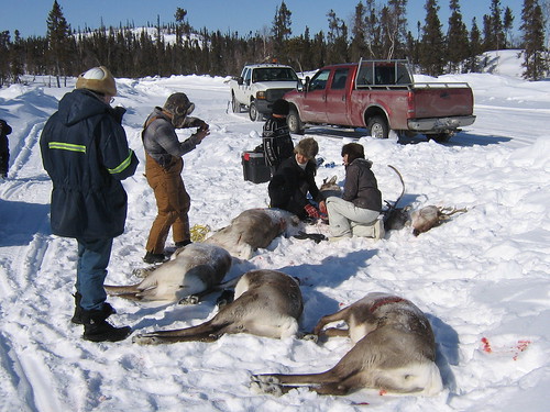
"City Girls" working on caribou.
I would have loved to have stayed and gone for a hunt however I am here working and I had to get back to site. Again the Kelly Kettle was used and viewed with amazement and promises that as soon as they get home “I’ll be ordering one of them”.
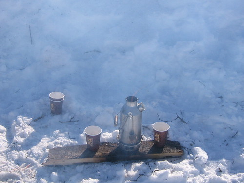
Kelly Kettle at work.
Today we had a group of ten NWT Wildlife Officers arrive at camp, they are up here to conduct a caribou survey. They will be using two trucks, two skidoo and a twin otter plane to find and count the animals.
Well I’ve got to go and do some laundry.
Cheers
Pat
Two Days in April...
Saturday, April 04, 2009, 9:26:39 AM | donkeycat
April 2. 2009
Not to much happened today, work on site as usual.
Ford and I spotted a heard of caribou about 40 strong laying on the lake at the south end of portage 45. I tried to get a photo but my camera did not want to work. It seams to be cold enough that the life is sucked out of the batteries within a very short time, even though I keep the camera warm.
We did see a lone wolf chasing a group (5 to 6) caribou across the lake. He did not catch any, looks like he will go hungry fro another day.
April 3, 2009
We continued to burn the head frame and the water tower base and the Haz-Mat crew stripped the asbestos of the three more building for us, so they are now ready to burn.
It is amazing how mane of the work force on this project I know from working on other sites in the north.
I did bring my Kelly kettle with me (it always travels with me when I go out of town) and I was showing it to one of the boys at the mine site, well after that everybody in camp was examining it from every angle to see how it works and now and they all want one. There may be a rush on them at Lee Valley in the next little while.
Just some photos of the wildlife and the land.
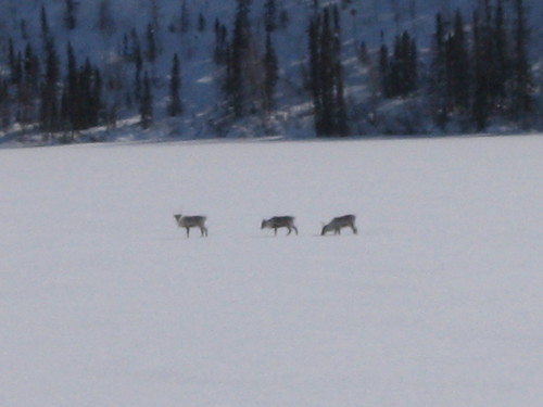
Caribou on Cranston Lake.

Ptarmigan on ice road.
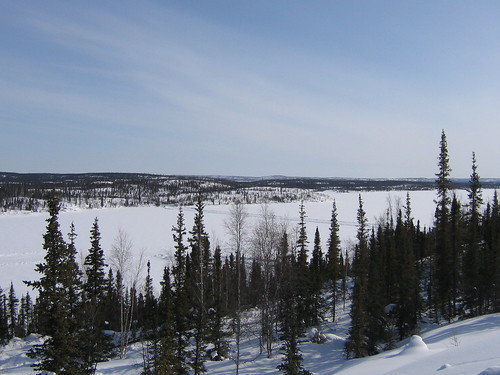
Indin Lake from the top of the site, view south east.
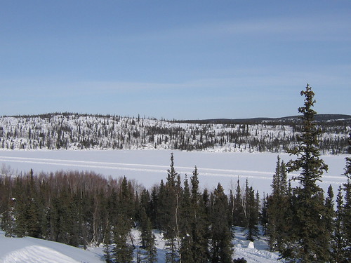
Indin Lake from top of the site, view north.
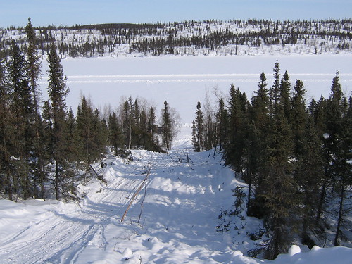
CAT trail from the top of the site to the lake. this would put to shame some of the ski hills in Ontario.
And of the site.
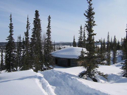
The mine managers cabin.
His outhouse.
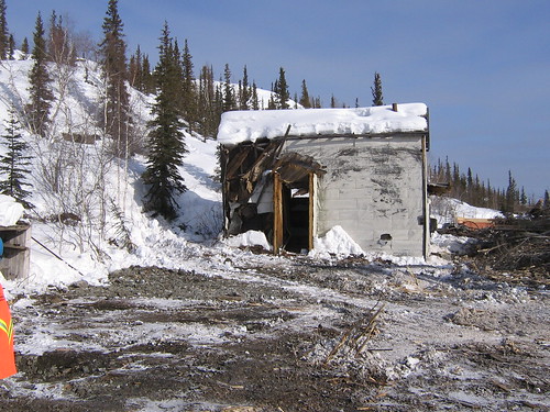
The mine dry (in english the means the place where miners change from underground clothing to surface clothing).
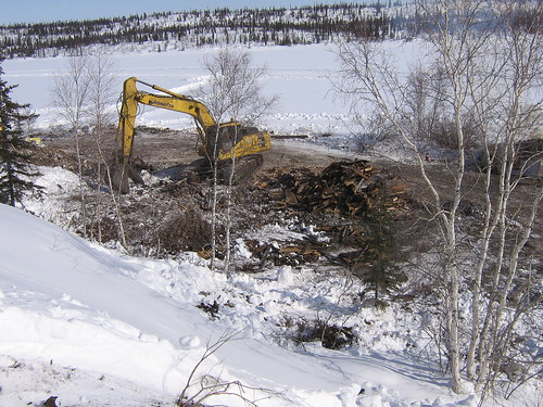
The mine site with the dry, blacksmith hoist house, headframe and powerhouse gone.
There are more caribou on the lakes and roads, and we are expecting a plane load of wildlife officers at camp for a caribou count this weekend.
Cheers
Pat
Cheers
Pat
An abnormal way of getting warm:
Wednesday, April 01, 2009, 8:00:04 PM | donkeycat
Standing on Inden lake in the -20’s °C, and looking at the large and very heavy boiler that we will be shipping to the Giant Mine in Yellowknife, the Poem “The Cremation of Sam McGee” by Robert W. Service came to mind..
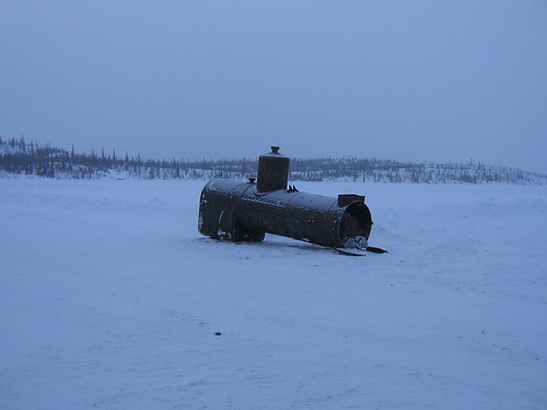
Poem: The Cremation of Sam McGee
(an abnormal way of getting warm in the freezing conditions of a Canadian winter as expressed by Robert Service)
by Robert W. Service
There are strange things done in the midnight sun
By the men who moil for gold;
The Arctic trails have their secret tales
That would make your blood run cold;
The Northern Lights have seen queer sights,
But the queerest they ever did see
Was that night on the marge of Lake Lebarge
I cremated Sam McGee.
Now Sam McGee was from Tennessee, where the cotton blooms and blows.
Why he left his home in the South to roam ‘round the Pole, God only knows.
He was always cold, but the land of gold seemed to hold him like a spell;
Though he’d often say in his homely way that “he’d sooner live in hell.”
Why he left his home in the South to roam ‘round the Pole, God only knows.
He was always cold, but the land of gold seemed to hold him like a spell;
Though he’d often say in his homely way that “he’d sooner live in hell.”
On a Christmas Day we were mushing our way over the Dawson trail.
Talk of your cold! through the parka’s fold it stabbed like a driven nail.
If our eyes we’d close, then the lashes froze till sometimes we couldn’t see;
It wasn’t much fun, but the only one to whimper was Sam McGee.
Talk of your cold! through the parka’s fold it stabbed like a driven nail.
If our eyes we’d close, then the lashes froze till sometimes we couldn’t see;
It wasn’t much fun, but the only one to whimper was Sam McGee.
And that very night, as we lay packed tight in our robes beneath the snow,
And the dogs were fed, and the stars o’erhead were dancing heel and toe,
He turned to me, and “Cap,” says he, “I’ll cash in this trip, I guess;
And if I do, I’m asking that you won’t refuse my last request.”
And the dogs were fed, and the stars o’erhead were dancing heel and toe,
He turned to me, and “Cap,” says he, “I’ll cash in this trip, I guess;
And if I do, I’m asking that you won’t refuse my last request.”
Well, he seemed so low that I couldn’t say no; then he says with a sort of moan:
“It’s the cursed cold, and it’s got right hold till I’m chilled clean through to the bone.
Yet ‘taint being dead—it’s my awful dread of the icy grave that pains;
So I want you to swear that, foul or fair, you’ll cremate my last remains.”
“It’s the cursed cold, and it’s got right hold till I’m chilled clean through to the bone.
Yet ‘taint being dead—it’s my awful dread of the icy grave that pains;
So I want you to swear that, foul or fair, you’ll cremate my last remains.”
A pal’s last need is a thing to heed, so I swore I would not fail;
And we started on at the streak of dawn; but God! he looked ghastly pale.
He crouched on the sleigh, and he raved all day of his home in Tennessee;
And before nightfall a corpse was all that was left of Sam McGee.
And we started on at the streak of dawn; but God! he looked ghastly pale.
He crouched on the sleigh, and he raved all day of his home in Tennessee;
And before nightfall a corpse was all that was left of Sam McGee.
There wasn’t a breath in that land of death, and I hurried, horror-driven,
With a corpse half hid that I couldn’t get rid, because of a promise given;
It was lashed to the sleigh, and it seemed to say: “You may tax your brawn and brains,
But you promised true, and it’s up to you to cremate those last remains.”
With a corpse half hid that I couldn’t get rid, because of a promise given;
It was lashed to the sleigh, and it seemed to say: “You may tax your brawn and brains,
But you promised true, and it’s up to you to cremate those last remains.”
Now a promise made is a debt unpaid, and the trail has its own stern code.
In the days to come, though my lips were dumb, in my heart how I cursed that load.
In the long, long night, by the lone firelight, while the huskies, round in a ring,
Howled out their woes to the homeless snows—O God! how I loathed the thing.
In the days to come, though my lips were dumb, in my heart how I cursed that load.
In the long, long night, by the lone firelight, while the huskies, round in a ring,
Howled out their woes to the homeless snows—O God! how I loathed the thing.
And every day that quiet clay seemed to heavy and heavier grow;
And on I went, though the dogs were spent and the grub was getting low;
The trail was bad, and I felt half mad, but I swore I would not give in;
And I’d often sing to the hateful thing, and it hearkened with a grin.
And on I went, though the dogs were spent and the grub was getting low;
The trail was bad, and I felt half mad, but I swore I would not give in;
And I’d often sing to the hateful thing, and it hearkened with a grin.
Till I came to the marge of Lake Lebarge, and a derelict there lay;
It was jammed in the ice, but I saw in a trice it was called the “Alice May.”
And I looked at it, and I thought a bit, and I looked at my frozen chum;
Then “Here,” said I, with a sudden cry, “is my cre-ma-tor-eum.”
It was jammed in the ice, but I saw in a trice it was called the “Alice May.”
And I looked at it, and I thought a bit, and I looked at my frozen chum;
Then “Here,” said I, with a sudden cry, “is my cre-ma-tor-eum.”
Some planks I tore from the cabin floor, and I lit the boiler fire;
Some coal I found that was lying around, and I heaped the fuel higher;
The flames just soared and the furnace roared—such a blaze you seldom see;
Some coal I found that was lying around, and I heaped the fuel higher;
The flames just soared and the furnace roared—such a blaze you seldom see;
Then I burrowed a hole in the glowing coal, and I stuffed in Sam McGee.
Then I made a hike, for I didn’t like to hear him sizzle so;
And the heavens scowled, and the huskies howled, and the wind began to blow.
It was icy cold, but the hot sweat rolled down my cheeks, and I don’t know why;
And the greasy smoke in an inky cloak went streaking down the sky.
And the heavens scowled, and the huskies howled, and the wind began to blow.
It was icy cold, but the hot sweat rolled down my cheeks, and I don’t know why;
And the greasy smoke in an inky cloak went streaking down the sky.
I do not know how long in the snow I wrestled with grisly fear;
But the stars came out and they danced about ere again I ventured near;
I was sick with dread, but I bravely said: “I’ll just take a peep inside.
I guess he’s cooked, and it’s time I looked;” . . . then the door I opened wide.
But the stars came out and they danced about ere again I ventured near;
I was sick with dread, but I bravely said: “I’ll just take a peep inside.
I guess he’s cooked, and it’s time I looked;” . . . then the door I opened wide.
And there sat Sam, looking cool and calm, in the heart of the furnace roar;
And he wore a smile you could see a mile, and he said: “Please close that door.
It’s fine in here, but I greatly fear you’ll let in the cold and storm—
Since I left Plumtree, down in Tennessee, it’s the first time I’ve been warm.”
And he wore a smile you could see a mile, and he said: “Please close that door.
It’s fine in here, but I greatly fear you’ll let in the cold and storm—
Since I left Plumtree, down in Tennessee, it’s the first time I’ve been warm.”
There are strange things done in the midnight sun
By the men who moil for gold;
The Arctic trails have their secret tales
That would make your blood run cold;
The Northern Lights have seen queer sights,
But the queerest they ever did see
Was that night on the marge of Lake Lebarge
I cremated Sam McGee.
Found on web page: http://www.wordinfo.info/words/index/info/view_unit/2640/?letter=C&spage=26
March 31.2009 .. Spring at last..
Wednesday, April 01, 2009, 2:02:37 PM | donkeycat
Spring has sprung the grass is green I wonder where the birdies been….not here that’s for sure. We still have lots of snow, -240C and lots and lots of ice on the lakes.
My truck got a flat tire (rock cuts in the side wall) this morning so I had to take it to the mechanic to get a new one put on. Sounds easy enough….the truck has no spare and the mechanic has to find a tire (same size) and then has to fix the tire removal machine so he can use the same rim.
I did manage to make it out to site by hitching a ride with the camp medic (no worries..there was nobody hurt he just wanted to check on the first aid station to see if it was adequate for the site) on route along portage 46, just passed the narrow bridge, on Cranston Lake there was a small caribou herd, about 30 in total.
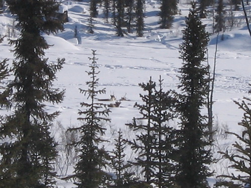
The mine shaft has now been completely exposed. It was a very small shaft only 5x10 feet, we do not know how deep in goes and that really does not matter we’ll cap it anyway.
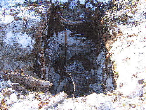
I met the Health and Safety Manager for Tli Cho Logistics, John Mackenzie, who was a miner and who also worked for Paddy Harrison. It’s a small, very small world.
Cheers for now
Pat
The days keep on rolling by…
Tuesday, March 31, 2009, 2:43:41 PM | donkeycat
And the weather is getting warmer. Today it’s -190C clear and bright, however with the wind it feels like -300C.
Work on site is going well. We are getting all the work done that needs to be done while we still have the winter road. And my fire pit is burning strong all day long. We shipped from the site several pieces of equipment that needed to go to Yellowknife today and several heritage items were put into storage at Colomac.
This is what my drive to work looks like. We have 7 portages to cross. I'll map them out later complete with GPS coordinates.
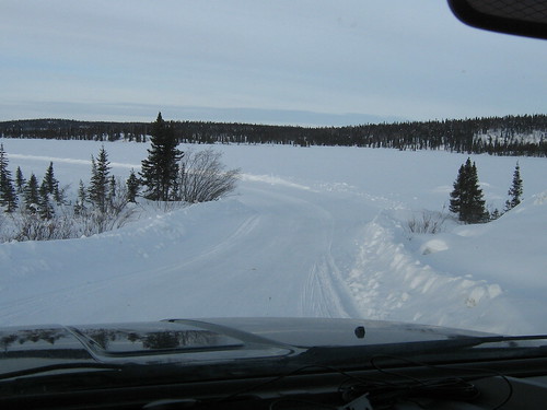
Leaving Colomac Mine site - the start of the ice road.
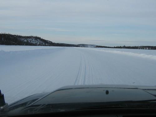
On Steeves Lake.
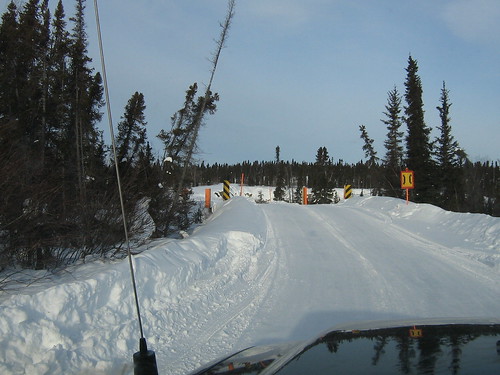
The narrow bridge crossing on Portage #46.
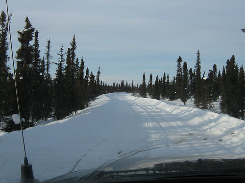
On one of the Portages.
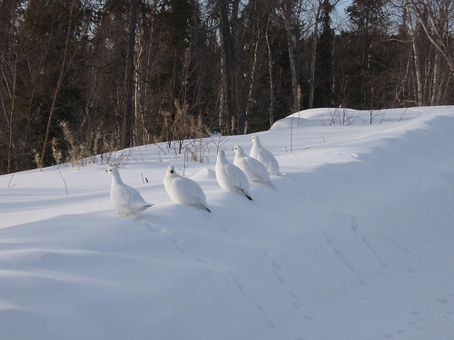
Ptarmigans on the roadside.
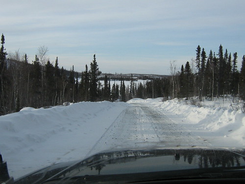
Portage road again.

The "Ice Road" maintance camp.
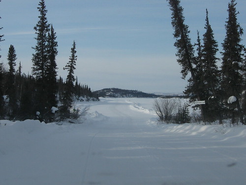
Typical portage to lake.
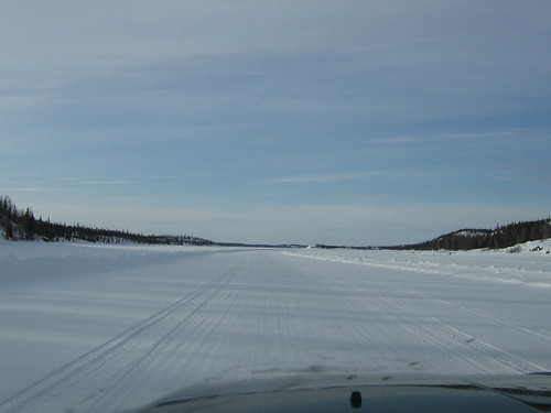
Back on the lake again this time on Indin Lake, the site is at the end of this road.
It’s beautiful and there is no traffic…well almost.... While traveling south (going to site) on portage number 45, I radioed my position in and continued on my way. Two thirds of the way down the portage route I came across another pick up truck traveling north. I tried to pull the shoulder (winter roads do not have shoulders and are only one lane wide as I soon found out) to allow him to pass and sunk my truck to the frame in snow.
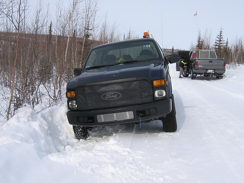
The truck that was coming north was one of the ice road security patrol trucks (the ones that you see on the TV show "Ice Road Truckers"), 45 minutes later (after contacting the backhoe operator on site) two of the crew arrived to pull me out of the ditch. I am going to get a chain for my truck.
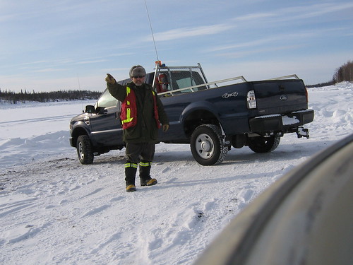
North is that way. Yes that's me under the fur hat standing on Indin Lake.
Cheers for now
Pat
Day 3 or is it day 4….
Monday, March 30, 2009, 9:25:06 AM | donkeycat
Time up here is measured a little differently. I asked one of the crew if it was Sunday and he looked at me and answered with out hesitation “yes it’s steak day” in order to be able to keep track of the days of the week you need two weeks in camp to get to know the dining menu.
Well nothing worth writing happened yesterday. It was cold -20oC but very bright. The sun reflecting off the snow can cause snow blindness very easily. We continued to work of the site, separating wood from metal and picking up fiberglass insulation from the buildings we had taken down already.
The site is located at N64o 15.921’, W115o 13.236’
March 29…-34oC and clear and bright, however it did warm up to -17oC by 1800hrs. spring is almost here!
I got a new fire pit for my back yard fires. This one is 6m across (I don’t think the fire department would like this one) and 1m deep. We will be burning all the building and head frame in it.

My new fire pit.
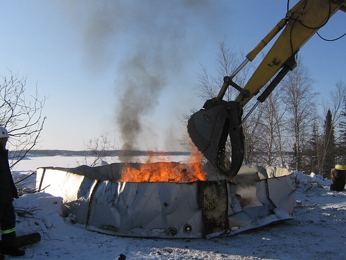
The only problem is I need a CAT 325B to add the fire wood.
Today on the way into work (on the ice road) we saw a very large moose, I tried to get a photo, but by the time I get the camera out the moose walked off into the trees. The truck has a back-up alarm that warns everything within 100m that you are moving. We also saw some very large wolf tracks. With any luck I’ll see the wolf and possible get a photo, if I don’t have to back up.
Here is a little history on the Colomac Mine
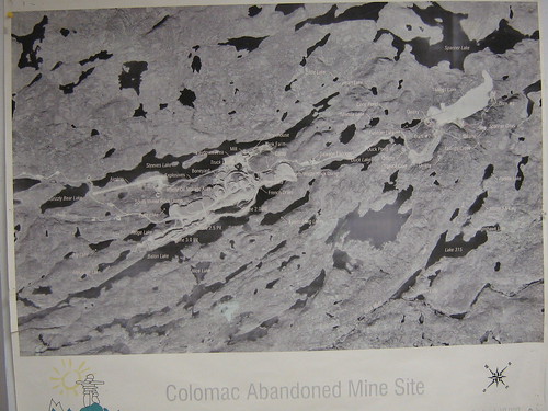
The presence of gold in the Indin Lake area 220 km northwest of Yellowknife was known since 1938. However, the area was not fully explored until 1945, when Giant Yellowknife Mines discovered gold mineralisation as a result of diamond drilling. Further exploration during 1946 led to the discovery of an extensive zone of low-grade gold mineralisation. The property was not placed into production at that time, as low gold prices did not make operations economically feasible. In 1974, Cominco optioned the property, and an exploration drilling program was conducted at the site. Neptune Resources Corporation obtained an option on the property from Johnsby Mines Ltd in 1986 and exercised this option in 1988. Neptune conducted extensive feasibility studies during 1988, and planned development of the site in 1989. Production was achieved at Colomac in May, 1990. All operations were suspended in June, 1991 due to low gold prices, high fuel costs, mechanical problems at the mill, and Neptune’s inability to pay the interest on a $150 million loan.
In April, 1993, Royal Oak Mines Inc acquired Neptune Resources Corporation, and thereby the Colomac site and resumed production in May 1994.
Mining operations were discontinued in September 1997 after depletion of reserves. The mine was closed in December 1997 after processing stockpiled ore.
This is one of three mines that reverted back to the Crown in 1999 when the mines’ owner at the time, Royal Oak Mines Inc., went into receivership.
Why is it a contaminated site?
One of the main concerns at Colomac is “tailings water”- contaminated water produced by the processing of the gold ore. The tailings water is contaminated with cyanide, a chemical that was used to get the gold out of the ore, among other substances. Currently, the contaminated water is safely contained in two areas, the Tailings Containment Area (TCA) and a mined-out pit known as Zone 2 Pit. At present, both areas contain approximately 10 million cubic metres of water. However, rainfall and snowmelt will eventually fill both the TCA and Zone 2 Pit.
One of the main concerns at Colomac is “tailings water”- contaminated water produced by the processing of the gold ore. The tailings water is contaminated with cyanide, a chemical that was used to get the gold out of the ore, among other substances. Currently, the contaminated water is safely contained in two areas, the Tailings Containment Area (TCA) and a mined-out pit known as Zone 2 Pit. At present, both areas contain approximately 10 million cubic metres of water. However, rainfall and snowmelt will eventually fill both the TCA and Zone 2 Pit.
What’s going on at the site?
After extensive community consultation, DIAND filed a Remediation Plan with the Mackenzie Valley Land and Water Board on March 31, 2004. This plan recommends Enhanced Natural Removal as the best remediation option for tailings water. This involves adding phosphorus to the contaminated water, which promotes the growth of algae. The algae breaks down cyanide and ammonia into non-toxic substances. Measurements over the past three years have shown that this process successfully reduces contaminants, including cyanide and ammonia.
After extensive community consultation, DIAND filed a Remediation Plan with the Mackenzie Valley Land and Water Board on March 31, 2004. This plan recommends Enhanced Natural Removal as the best remediation option for tailings water. This involves adding phosphorus to the contaminated water, which promotes the growth of algae. The algae breaks down cyanide and ammonia into non-toxic substances. Measurements over the past three years have shown that this process successfully reduces contaminants, including cyanide and ammonia.
A lot of other remediation work continues to be done at the site, including an eight-kilometre fence installed to prevent caribou and other wildlife from entering the tailings containment area. DIAND is working in partnership on the Colomac project with the Tlicho people, who live in the area. The site operator is Tli Cho Logistics, a Dogrib company, and the majority of the workforce are Tlicho people.
Future Plans
Once the new water licence and land-use permit are issued, implementation of the large remediation tasks can begin. Remediation of the entire site is expected to be completed by 2010. This will be followed by monitoring for about five years to confirm that the remediation measures are effective.
Once the new water licence and land-use permit are issued, implementation of the large remediation tasks can begin. Remediation of the entire site is expected to be completed by 2010. This will be followed by monitoring for about five years to confirm that the remediation measures are effective.
I found this web site (http://explorenorth.com/library/mining/nwt-contaminated_sites.html) about the contaminated sites in NWT, and I have worked on or visited 6 of the 11.
Well that all for now. It’s 2100hrs and I’m getting tird.
Cheers
Pat
Colomac day 2….
Saturday, March 28, 2009, 8:55:21 AM | donkeycat
Well here it is March 27, 2009 and I’m still wearing Nipigon lingerie (long underwear and wool socks). The weather today was warm only -9oC (but it’s a dry cold…) so most of us were out in only our fleeces, however it did snow all day.
Our day up here starts at 0530hrs with breakfast, at 0603hrs there is the daily tailgate (safety and daily work plan) meeting and then off to the site. Back to the camp for ½ hour lunch then back to the site until 1800hrs. Dinner is at 1830hrs and then for some of us its report writing time. To date the only wildlife I have seen has been a pair of ptarmigans and a red fox and a couple of caribou, however the site supervisor has also seen a wolverine and 50-60 caribou on the road.
I spent the day working with the surveyor setting and locating the bench marks we will need on the site to complete the topographic survey of North Inca mine site. We had to trudge through hip deep snow (no snowshoes on site) and then dig down to bare rock to drill and set the points.
We have taken down the metal buildings and sent the back to Colomac to be land filled there and are now preparing to burn the head frame. Locating the drums in the snow and woods in kind of like a scavenger hunt, they use skidoos and komatik (large freight sleds) and a lot of muscle to haul the barrels out.
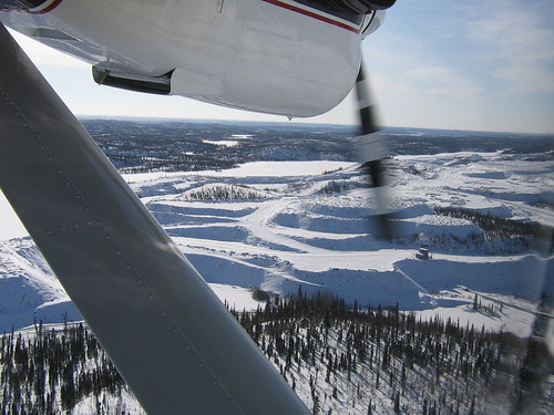
Colomac Mine site from the air.
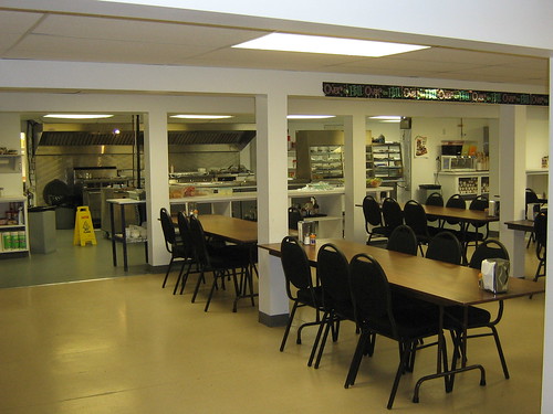
Our dinning room, our chef learned to cook in the Royal Navy.
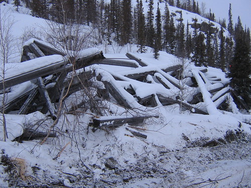
The former head frame at North Inca.
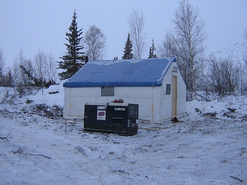
Our winter shelter on site.
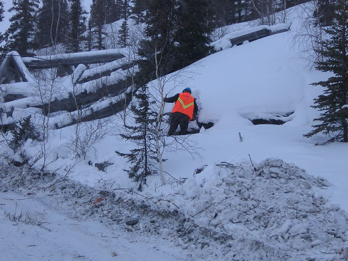
Surveying.
The days are long, the food is great, the bed is comfortable and I’m tired but feeling good.
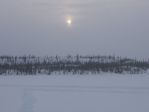
Afternoon sun over Indin Lake.
Well it’s time to hit the sheets.
Cheers
Pat
Day 1 at Colomac…
Thursday, March 26, 2009, 8:29:27 PM | donkeycat
We left Yellowknife at 1010hrs in a new twin engine otter (just had a complete overhaul and a rebuild inside. This was its first commercial flight) a quick stop in Rae to pick up a few people and then we were at Colomac for lunch. The rest of the day was spent trying to get my computer working, a site orientation meeting and quick trip to the work site.
The camp is the best I’ve stayed in so far. It is a hard (a raised building used as the dinning and recreation center, with several attached trailers that contain the offices and sleeping quarters) camp that is maintained year round, I’ve heard that it will sleep 200 and has a kitchen to match. There is a TV room, a games room, a smoking room, several washrooms and a gym. The food..what to say, there is a reason that people come to work in these places..so far has been excellent, lunch was cold buffet and dinner was 1” thick slabs of prim rib with all the trimmings and an almost endless case of deserts. The only thing that can take some time to get use to is the phone system. There is a time delay and if you don’t pay attention you can end up talking over the other person.
The work site is a 30-45 minute drive on an ice road that crosses over lakes and portages. There is not much to see at the site now as it is still covered in 3 feet of snow, tomorrow I will walk the site with the surveyor and take some photos and get a feel for the place.
On the trip back from the site we saw two caribou in the trees, I tried to get a couple of photos but my camera was frozen. The site supervisor (Ford Tucker) mentioned a mining contractor by the name of “Paddy Harrison” that he had worked for many, many years ago in Newfoundland. When I told him that I did know the name, he broke out into laughter and started telling some stories about working with my grandfather.
I also heard that the northern lights are out in force and I’ll try to get some photos of these as well.
Cheers
Pat
And thus it begins!
Thursday, March 26, 2009, 2:48:02 PM | donkeycat
Our summer program in the Northwest Territories has started early…
Today I found myself leaving the warm (00C) weather in Toronto to overnight in Yellowknife (-150C) before heading farther north to the Colomac Mine site where I will be staying while working at North Inca Mine site..
I checked into my hotel to find that there is no converter for the TV no coffee maker and they do not have a dining room any longer, however there was a cold beer in the room fridge!
First a little background on North Inca….
The North Inca advance exploration mine site was an underground gold prospect from 1947 to 1949 with limited exploration activities also undertaken intermittently between 1949 and 1980.
The mine site is located approximately 120 km north northwest of Yellowknife in the Northwest Territories, Canada and is situated at the southern point of land on the Inca Peninsula on Indin Lake. It is approximately 14 km south of the Colomac mine site. During the open water season both these sites are accessible only by air, however during the winter season there is an ice road that connects Yellowknife to the Colomac site and a spur line is has been run into the North Inca mine site from this road.
Updates to follow…
Cheers
Pat
It's been 6 months since my last admission!
Sunday, February 15, 2009, 8:18:47 AM | donkeycat
Well a lot (and I do mean a lot) has happened since I last put pen to paper or in this case fingers to keyboard.
Were to start…I might as well start from where I left off:
September 20, Thomas turned one year old;
My youngest son has just turned one...we had a party for him at the house and had big brother and sister and all his cousins over for cake.

Thomas turns one.

Having his cake and eating it to!
(left to right, back to front:)
Kaitlyn, Nicholas, Shannon
Nyla, Kiernan
Michael, Aidan, Thomas, Taisi, Harrison

Thomas and big sister Sydnee.
Later that night we (including Thomas) sat and enjoyed the night sky and good conversation around a camp fire in the back yard (as so often happens at this house), a damper was put on our fun by the neighbor behind us calling the fire department (as so often she when we have a fire), however this worked out in our favor for a change, the fire chief did not make us put the fire out, all the ladies at the party had there pictures taken with York Regions finest
Nadia, fireman, Natasha, fireman, Shelly
and Thomas got to see a fire truck up close, and to the chagrin of the neighbors the Fire Chief blasted the trucks horn and then had the driver set off the lights and siren in honor of Thomas’ birthday.
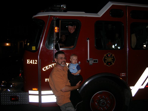
Thomas and firetruck.
Holloween found Thonas prowling the neighborhood as a skunk.

Thomas in the pumkin patch.
Thomas driving the hay wagon.
Thomas as a skunk.

Thomas as a skunk.

Starting to prowl the neighbourhood.
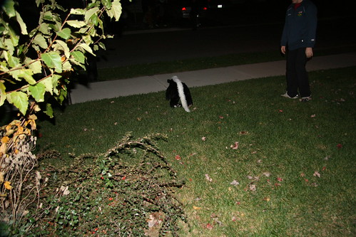
His escape to the street.
November added an element of surprise and danger (although we had all the safety measures in place) to my work. The surprise was that I was going to be looking (through the use of drilling and test pitting) for a dump site at Canadian Forces Base Borden that had contained drums of mustard gas; this was also the dangerous part! A bit of background: the army had developed and stored this chemical weapon, and at the end of the Second World War declared it surplus, and proceeded to dump (in the ocean) and bury it. The work I was doing was done to confirm that no drums containing mustard gas were remaining (they were supposed to have been removed) in the dump site. The next part of the surprise/puzzle was we were told that there were two dump sites, but we were shown three locations and through discussions with people in the museum on base, I heard of a fourth location. Sort of sounds like Russian roulette. Anyhow I ended up investigating the three most likely sites and found nothing. Was it removed or was it never buried there? Mystery or Conspiracy?
It was also during November that I found out that my brother-in-law and hunting partner and his family are moving home to Newfoundland in the spring/summer. We are going to miss them, but we wish them all the best and are a little jealous.
December was relatively quiet; we managed to stay out of the malls and away from the commercial side of Christmas.

Getting ready for Christmas.

Mother and son Christmas day.
We all (that is the Ed and Georgia Harrison Clan) met at my sisters Sandra house for a wonderful Christmas dinner.

(left to right, back to front)
Dad, Colleen, Jeff, Sandra
Mom, Rebecca, James,Tonis, Sue, Michael, Sydnee
Taisi, Nyla, Aidan
Pat, Shelly, Dave
Thomas, Harrison
There are nineteen of us now and growing year by year. Next year there will Jeff (my brother) and Colleen’s little girl Jorja and James (my son) and Rebecca’s little one……YES I’M GOING TO BE A GRANDPA….and could not be happier about it and yes that means that Thomas will be an uncle…do they ever grow up fast, LOL…and dad you will be a Great Grandfather, bet you never thought you would have your grandson and his nephew on your knee at the same time.
New Years Eve was very quiet around this house, we watched the time roll by in St. John’s (via the internet) put our coins out, and wished each other “Happy New Year” then retired for the rest of the year (one and a half hours). The rest of January was spent in anticipation of our upcoming adventure…St. Maartin N.A.
February - Trip to St. Maartin N.A.
Our trip started at 0230hrs on January 31st with loading the truck for the drive to the airport, then we had to wake and get Thomas ready to go. The drive to the airport was uneventful and check-in was a breeze (traveling with a baby meant moving to the front of the line) however getting through security was another story…it took an hour of standing in line. The flight down was good and the people at Air Transat (airplane and counter staff) were fantastic. We stayed at the Sonesta Maho Beach Resort on the Dutch side of the island.
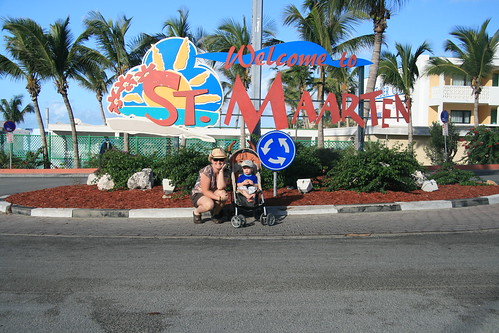
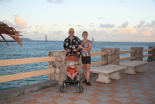
The ocean view terrace of our hotel.
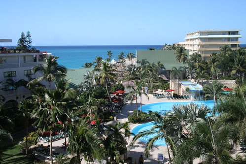
The pool area from our room balcony.
The resort was very nice but not geared for families with small children. We made it work though. The end of the runway for the airport is at the beach of our hotel, and we saw a continuous stream of planes landing, from the small private jets to the island hopper airlines to the 747’s arriving from Europe.
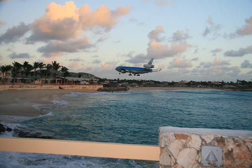
From the ocean view terrace, jets landing at St. Maartin airport.
The island is only 38 sq.miles and split in approximately half with Dutch (17 sq miles) on the south and French (21 sq miles) on the north. There is no problems with crossing the border between the two countries, for sight seeing, shopping or the beaches. The beaches are great, but at this time of year the sea is a bit rough and the visibility is poor, so no diving this trip.
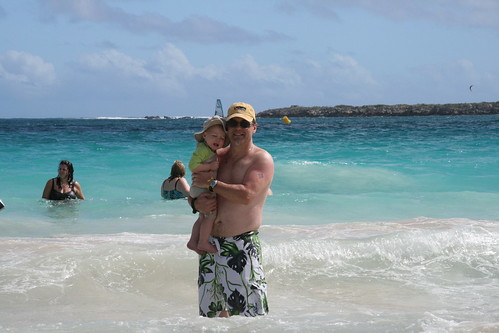
Thomas and dad at Grand Case Beach.
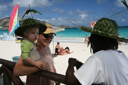
Thomas gets a new hat.
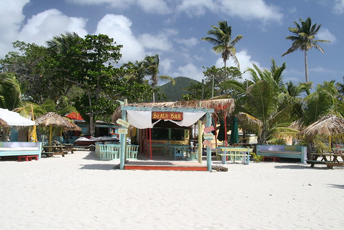
Beach bar at Simpson Bay Beach.
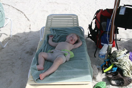
Relaxing in the shade.
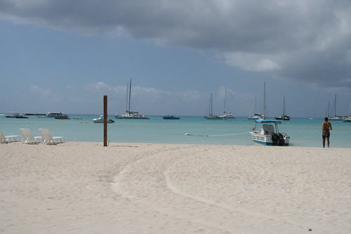
Simpson Bay.

Night life at Cheri's Cafe.

Thomas hitting the dance floor.
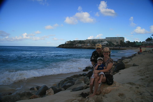
Moho Beach, our hotel is in the background.
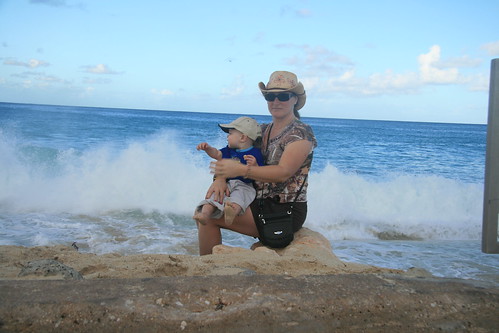
Mom and Thomas watching the surf at Moho Beach.
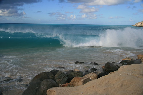
Surfs up at Moho Beach.
We did tour the island and took in several of the beaches (on the Dutch side – Simpson Bay, Maho, Mullet and Great Bay, on the French side – Orient, Grand Case) as well as a trip to each of the capitals Philipsburg on the Dutch and Marigot on the French. Our return trip was plagued with problems. We had an early rise and breakfast in preparation for the return flight and on the way back to the room we were informed that out flight would be delayed two to three hours because of an unknown problem with the plane (they suspected the landing gear), now no rush to get packed. We were then informed that the flight would be delayed by another five hours. What to do now? Back to the beach and the pool and to drown our sorrows in BBC’s (a local island drink of Baileys, banana cream bar mix, Cream de cacao, amaretto and crushed ice, chocolate sauce and cinnamon) and cold beer. A few more hours of lounging in the sun then it was off to the airport and home.

Now that we have returned and settled back into the routine of work and home life it’s time to start preparations for our next trip.
Thomas getting ready to play in the yard.
We are in the process of planning a camping week in Allegany State Park, New York State.
It was also in February that I was informed that I will be testing for my black belt in May.
And that should being us up to date.
Cheers
Pat
Happy Birthday to my son James.
Thursday, September 04, 2008, 5:51:30 PM | donkeycat
August 30, 2008
My oldest son just turned 25 today...I'm very proud of him. He is a chef at Splendido, a restaurant in toronto. This is taken from http://www.10best.com/Toronto,ON/
Softly lit, this elegant, intimate restaurant glimmers with mirrors and stemware. Headed by chef David Lee, the kitchen creates singular dishes that marry local ingredients with a Mediterranean sensibility. Australian rack of lamb with white bean and butternut squash cassoulet, grilled halibut with herbed potato gnocchi, and thyme-roasted chicken breast allude to the treats in store. Finish up with the daily sorbet or a plate of fine cheeses and dried fruits, and further entertain your palate with the diversity of flavors. Tasting menus, a global winelist, and praise from critics and patrons alike render Splendido a top culinary destination.
And my youngest son is almost one year old...
Well Hall Beach is quite the place…the landscape is flat, windswept, covered in gravel and cobbles and small lakes. There are small, very small pockets of plant growth. The town is only about 700 people including Inuit, southerners (anybody from south of the arctic circle – most come from NFLD and PQ – and they run the Co-Op, teach, contractors working the Dew-line early warning station, RCMP, etc. it seems to be anything that requires specialized skills). The town in built on the shores of the Arctic Ocean with beaches of cobble and where the seaweed struggles to keep a roothold in the pounding surf.
The days were long but I did manage to survey all the buildings in the two days, it helped that the RCMP were not busy with court or tending to any guests or issues in town and therefore were available to help me gain access to all the buildings and even work late. As I have said before of the RCMP officers in Nunavut holds true here in Hall Beach as well, the two officers here were extremely helpful, and very friendly. The Dew-line base is a great place to go for lunch and very accommodating to those from out-of-town and the food is fantastic.
The hotel is just a step above the Tayoloak hotel, I have my own bathroom here…however there is no breakfast service (only cereal and toast available) again first up makes the coffee, no lunch service, and dinner is served at 1800hrs sharp. The meals are not to bad but the vegetables are over boiled, and the meat is tastless..lots of salt and steak sauce. The room has two single beds (no roommate this time) however the mattress springs manage to stick into you no matter how you lie. The TV does have a remote control, not that that matters because there are not too many channels to chouse from. And when you have strong winds (I heard the pilots at the Dew-line say the winds were 60km/hr plus, and therefore they were not flying their helicopters for the last two days) the satellite cuts in and out.
The other day the RCMP took me down the beach to see what was left of the bow-head whale that was caught here a few days before I arrived, my timing sucks, all that was left was the jaws and some chunks of skin.
I’ll add some photos when I get the chance.
Cheers
Pat
In the air again…air miles are building up!
Thursday, September 04, 2008, 5:48:09 PM | donkeycat
August 28, 2008
Yesterday was a travel day..we left Yellowknife at ----- en-route for Rankin Inlet and then Iqaluit and of course it is all weather dependent…we were told that it was going to be a bumpy flight and it was rough (the song “The Wreck Of The Edmund Fitzgerald” was stuck in my mind) upon reaching Rankin Inlet (which was fogged in) the capten came over the radio and informed us “he was going to give it a shot” referring to the landing and if it was a no go “we would be pulling up at the last moment” and we did! The only thing I saw from my window was (during descent) fog, fog, fog, water, (assent) fog, fog, fog and then we were informed that we were on our way to Iqualuit, and that those who had missed their stop should go to First Air’s check-in counter upon our arrival.
Travel in the arctic is not easy and does not run on a tight schedule…as I have said there is the “weather dependant” aspect. Also these flights (the ones I have been on) have no more than 7 to 10 passengers, and in the smaller communities it is not uncommon for a flight to be held up while they wait for someone to arrive at the airport. There are also on flights across the arctic, flights in the western arctic are out of Yellowknife and those in the eastern arctic are out of Iqaluit. For me to go from Taloyoak to Hall Beach (direct if any flights went there would be less than two hours) I have to travel back to Yellowknife (Taloyoak to Kugaaruk to Gjoa Haven to Yellowknife, aprox. 5 hours of travel) overnight in Yellowknife and then Rankin Inlet (2 ½ hours) and Iqaluit (2 ½ hours) overnight in Iqaluit and another 2 hours to hall beach. There is no quick and easy way around this massive land.
It’s now 0830hrs and I’m sitting in the ATR-42, seat 9D, on en-route to Hall Beach, I get to share this plane with 3 other passengers, and a crew of 3. As I look around everybody in the passenger cabin appears to be asleep, including the flight attendant (no worries though – we did get our coffee and a bit of a breakfast snack) so I thought I would put something together about Nunavut.
Nunavut:
Area: 1.994 million square kilometers (about 20% of Canada’s area)
Population: 31,113 according to Statistics Canada
Capital city: Iqaluit with a population of 7,250 (greater than 50% of the territorial population). The city is located at 63o45’N, 68o31’W. The name Iqaluit means “place of many fish” in Inukititut.
I was going to write a little something on the history, but I found that “Native People: Arctic, by Author Milton R. Freeman covered it all. If you are interested check it out at http://www.thecanadianencyclopedia.com/index.cfm?PgNm=TCE&Params=A1SEC883639
Photos to be added when I get the time.
Cheers
Pat